National Register of Historic Places listings in Jerauld County, South Dakota

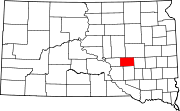
This is a list of the National Register of Historic Places listings in Jerauld County, South Dakota.
This is intended to be a complete list of the properties on the National Register of Historic Places in Jerauld County, South Dakota, United States. The locations of National Register properties for which the latitude and longitude coordinates are included below, may be seen in a map.[1]
There are 15 properties listed on the National Register in the county.
This National Park Service list is complete through NPS recent listings posted June 7, 2024.[2]
Map all coordinates using OpenStreetMap
Download coordinates as:
- KML
- GPX (all coordinates)
- GPX (primary coordinates)
- GPX (secondary coordinates)
Current listings
| [3] | Name on the Register[4] | Image | Date listed[5] | Location | City or town | Description |
|---|---|---|---|---|---|---|
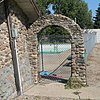
| 1 | Alpena Bathhouse and Swimming Pool |   More images More images | June 22, 2000 (#00000727) | Junction of 5th and Main 44°10′51″N 98°22′14″W / 44.180849°N 98.370657°W / 44.180849; -98.370657 (Alpena Bathhouse and Swimming Pool) | Alpena | |
| 2 | Archeological Site 39JE10 | Upload image | February 23, 1984 (#84003336) | Address restricted[6] | Wessington Springs | |
| 3 | Archeological Site 39JE11 | Upload image | February 23, 1984 (#84003337) | Address restricted[6] | Gann Valley | |
| 4 | Harmony Friends Church |   More images More images | September 1, 2015 (#15000565) | 225th St. & 372nd Ave. 44°07′25″N 98°45′06″W / 44.1236°N 98.7516°W / 44.1236; -98.7516 (Harmony Friends Church) | Wessington Springs vicinity | |
| 5 | Hawkeye Valley Mill |   More images More images | January 23, 2013 (#12001216) | Southeastern ¼ of Section 23, Township 106 North, Range 65 West[7] 43°58′19″N 98°35′30″W / 43.972025°N 98.591658°W / 43.972025; -98.591658 (Hawkeye Valley Mill) | Wessington Springs | |
| 6 | Jerauld County Courthouse |   More images More images | February 10, 1993 (#92001860) | 205 S. Wallace[8] 44°04′42″N 98°34′12″W / 44.078342°N 98.569945°W / 44.078342; -98.569945 (Jerauld County Courthouse) | Wessington Springs | |
| 7 | Methodist Episcopal Church of Wessington Springs |   More images More images | December 17, 1999 (#99001582) | Southeastern corner of Main and State Sts. 44°04′47″N 98°34′19″W / 44.079686°N 98.571929°W / 44.079686; -98.571929 (Methodist Episcopal Church of Wessington Springs) | Wessington Springs | |
| 8 | Municipal Field House |   More images More images | June 2, 2000 (#00000600) | 418 2nd St., SW. 44°04′37″N 98°34′22″W / 44.077050°N 98.572714°W / 44.077050; -98.572714 (Municipal Field House) | Wessington Springs | |
| 9 | L.P. Nielson Barn |   More images More images | December 15, 2004 (#04001363) | 23251 393rd Ave. 44°01′04″N 98°21′15″W / 44.017806°N 98.354177°W / 44.017806; -98.354177 (L.P. Nielson Barn) | Woonsocket | |
| 10 | Shakespeare Garden and Shay House |   More images More images | November 14, 1979 (#79003681) | 501 Alene Avenue N[9] 44°05′03″N 98°34′32″W / 44.084273°N 98.575514°W / 44.084273; -98.575514 (Shakespeare Garden and Shay House) | Wessington Springs | |
| 11 | Robert S. Vessey House |   More images More images | April 26, 1978 (#78002560) | 109 N. College Ave.[10] 44°04′49″N 98°34′27″W / 44.080140°N 98.574099°W / 44.080140; -98.574099 (Robert S. Vessey House) | Wessington Springs | |
| 12 | Wessington Springs Carnegie Library |   More images More images | June 3, 1999 (#99000677) | 109 W. Main Street[11] 44°04′45″N 98°34′20″W / 44.079172°N 98.572189°W / 44.079172; -98.572189 (Wessington Springs Carnegie Library) | Wessington Springs | |
| 13 | Wessington Springs Opera House |   More images More images | July 21, 1976 (#76001738) | 111 Dakota Ave., N.[12] 44°04′48″N 98°34′14″W / 44.080133°N 98.570612°W / 44.080133; -98.570612 (Wessington Springs Opera House) | Wessington Springs | |
| 14 | H.P. Will House |   More images More images | February 5, 2003 (#02001763) | 207 Alene Ave., N.[13] 44°04′52″N 98°34′32″W / 44.081247°N 98.575544°W / 44.081247; -98.575544 (H.P. Will House) | Wessington Springs | |
| 15 | Zion Emmanuel Lutheran Church | Upload image | October 23, 2023 (#100009483) | 320 Oak Ave. 44°04′10″N 98°25′36″W / 44.0694°N 98.4266°W / 44.0694; -98.4266 (Zion Emmanuel Lutheran Church) | Lane |
See also

Wikimedia Commons has media related to National Register of Historic Places in Jerauld County, South Dakota.
- List of National Historic Landmarks in South Dakota
- National Register of Historic Places listings in South Dakota
References
- ^ The latitude and longitude information provided in this table was derived originally from the National Register Information System, which has been found to be fairly accurate for about 99% of listings. Some locations in this table may have been corrected to current GPS standards.
- ^ National Park Service, United States Department of the Interior, "National Register of Historic Places: Weekly List Actions", retrieved June 7, 2024.
- ^ Numbers represent an alphabetical ordering by significant words. Various colorings, defined here, differentiate National Historic Landmarks and historic districts from other NRHP buildings, structures, sites or objects.
- ^ "National Register Information System". National Register of Historic Places. National Park Service. April 24, 2008.
- ^ The eight-digit number below each date is the number assigned to each location in the National Register Information System database, which can be viewed by clicking the number.
- ^ a b Federal and state laws and practices restrict general public access to information regarding the specific location of this resource. In some cases, this is to protect archeological sites from vandalism, while in other cases it is restricted at the request of the owner. See: Knoerl, John; Miller, Diane; Shrimpton, Rebecca H. (1990), Guidelines for Restricting Information about Historic and Prehistoric Resources, National Register Bulletin, National Park Service, U.S. Department of the Interior, OCLC 20706997.
- ^ West side of county road 380 Ave, north of 236 St: see 2017 photo
- ^ "Jerauld County Court System". South Dakota Unified Judicial System. Retrieved 2017-09-07.
- ^ "Shakespeare Garden & Anne Hathaway Cottage". Travel South Dakota. Retrieved 2017-08-24.
- ^ The NRHP nominating form for the Vessey house gives its address as "118 College Avenue". However, in this 2017 photo, the house number "109" is visible on the right side of the doorframe.
- ^ "Wessington Springs Carnegie Library". Retrieved 2017-09-07.
- ^ The NRHP nominating form gives the opera house's address as "111 Dakota Avenue N." This address is incorrect or outdated: when photographed in 2017, the opera house was on the even-numbered side of the street. There was no street number on the building, but this 2017 photo shows the opera house reflected in the window of 109 Dakota Avenue N., across the street.
- ^ The NRHP nominating form gives the address as "214 Alene Ave. N." However, the street number "207" is visible to the left of the front door in this 2017 photo.
- v
- t
- e


county
- Aurora
- Beadle
- Bennett
- Bon Homme
- Brookings
- Brown
- Brule
- Buffalo
- Butte
- Campbell
- Charles Mix
- Clark
- Clay
- Codington
- Corson
- Custer
- Davison
- Day
- Deuel
- Dewey
- Douglas
- Edmunds
- Fall River
- Faulk
- Grant
- Gregory
- Haakon
- Hamlin
- Hand
- Hanson
- Harding
- Hughes
- Hutchinson
- Hyde
- Jackson
- Jerauld
- Jones
- Kingsbury
- Lake
- Lawrence
- Lincoln
- Lyman
- Marshall
- McCook
- McPherson
- Meade
- Mellette
- Miner
- Minnehaha
- Moody
- Oglala Lakota
- Pennington
- Perkins
- Potter
- Roberts
- Sanborn
- Spink
- Stanley
- Sully
- Todd
- Tripp
- Turner
- Union
- Walworth
- Yankton
- Ziebach
 Category
 List
List National Register of Historic Places Portal


