Limestone Link
Long-distance footpath in Somerset and Gloucestershire, England
| Limestone Link | |
|---|---|
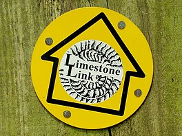 Footpath waymark sign for the Limestone Link | |
| Length | 36 mi (58 km) |
| Location | South West England |
| Trailheads | Mendip Hills / Cotswolds |
| Use | Hiking |
| Difficulty | Moderate to strenuous |
| Sights | Mendip Hills |

The Limestone Link is a 36-mile (58 km) long-distance footpath in England, from the Mendip Hills in Somerset to Cold Ashton in Gloucestershire. It is marked by an ammonite waymarker.
The Mendip section starts between Churchill and Rowberrow, near Dolebury Warren and travels roughly west to east, passing above the villages of Blagdon and Compton Martin, close to the northern boundary of the Mendip Area of Outstanding Natural Beauty; it then passes through West Harptree. It passes through Temple Cloud, Hallatrow and Camerton before turning north through Dunkerton and Southstoke, south of Bath.
The path then follows Cam Brook to Midford and then follows Midford Brook before joining the Avon Walkway at the Dundas Aqueduct. It continues north alongside the River Avon and the Kennet and Avon Canal, past Claverton and the Claverton Pumping Station to Bathampton. Here it crosses the A4 and goes through Batheaston and then, following a stream, through Northend and St Catherine. The final part of the path goes past Monkswood reservoir and alongside St Catherines Brook to reach Cold Ashton.
The footpath connects with the Mendip Way and the Cotswold Way.
External links
- Map of Mendip section from Mendip Hills AONB
- Description of walk from Temple Cloud to Bath
- Limestone Link from the Long Distance Walkers Association
- v
- t
- e
- Ashwick
- Axbridge
- Banwell
- Bishop Sutton
- Blagdon
- Bleadon
- Burrington
- Charterhouse
- Cheddar
- Chewton Mendip
- Churchill
- Compton Bishop
- Compton Martin
- Cross
- Draycott
- East Harptree
- Easton
- Hinton Blewett
- Hutton
- Leigh-on-Mendip
- Litton
- Oakhill
- Priddy
- Rodney Stoke
- Rowberrow
- Sandford
- Shepton Mallet
- Shipham
- Ubley
- Webbington
- Wells
- West Harptree
- Westbury-sub-Mendip
- Winscombe
- Wookey Hole
- Attborough Swallet
- Aveline's Hole
- Axbridge Ochre Mine
- Banwell Caves
- Banwell Ochre Caves
- Burrington Combe
- Charterhouse Cave
- Cheddar Gorge
- Compton Martin Ochre Mine
- Cox's Cave
- Eastwater Cavern
- Ebbor Gorge
- Fairy Cave Quarry
- GB Cave
- Goatchurch Cavern
- Gough's Cave
- Hunter's Hole
- Lamb Leer
- Longwood Swallet
- Manor Farm Swallet
- Picken's Hole
- Pierre's Pot
- Priddy Caves
- Read's Cavern
- Reservoir Hole
- Rhino Rift
- Rod's Pot
- Shatter Cave
- Shute Shelve Cavern
- Sidcot Swallet
- St Cuthbert's Swallet
- St. Dunstan's Well Catchment
- Stoke Lane Slocker
- Swildon's Hole
- Thrupe Lane Swallet
- Tyning's Barrow Swallet
- Upper Flood Swallet
- W/L Cave
- Wookey Hole Caves
- Asham Wood
- Axbridge Hill and Fry's Hill
- Banwell Caves
- Banwell Ochre Caves
- Barns Batch Spinney
- Blagdon Lake
- Bleadon Hill
- Brimble Pit and Cross Swallet Basins
- Burledge Hill
- Burrington Combe
- Chancellor's Farm
- Cheddar Complex
- Cheddar Reservoir
- Cheddar Wood
- Chew Valley Lake
- Cloford Quarry
- Compton Martin Ochre Mine
- Cook's Wood Quarry
- Crook Peak to Shute Shelve Hill
- Dolebury Warren
- Draycott Sleights
- Ebbor Gorge
- Emborough Quarries
- Harptree Combe
- Hobbs Quarry
- Holwell Quarries
- Kingdown and Middledown
- Lamb Leer
- Priddy Caves
- Priddy Pools
- Perch
- Rodney Stoke
- St. Dunstan's Well Catchment
- Sandpit Hole and Bishop's Lot
- Shiplate Slait
- Viaduct Quarry
- Windsor Hill Quarry
- Wurt Pit and Devil's Punchbowl
 | This Somerset location article is a stub. You can help Wikipedia by expanding it. |
- v
- t
- e
 | This British trail or long-distance path-related article is a stub. You can help Wikipedia by expanding it. |
- v
- t
- e
 | This Gloucestershire location article is a stub. You can help Wikipedia by expanding it. |
- v
- t
- e


