Kobuta, Pennsylvania
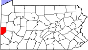
Kobuta is an unincorporated community that is located in Potter Township, Beaver County, Pennsylvania, United States.[1] It is situated next to the Ohio River, due west of Monaca, southwest of Industry, and southwest of Beaver.
History
The area was the site of a butadiene, and later a foamed polystyrene, chemical plant during World War II and in the 1950s that was owned by the Koppers United Company, the predecessor to Koppers Company, Inc. The company produced the chemical butadiene, an ingredient of synthetic rubber.
The name of the area came from the combination of "Koppers" and "butadiene". The community has largely disappeared from modern maps, except for a few business names.
Effectively all of Kobuta became part of the Pennsylvania Shell ethylene cracker plant when it opened in the early 2020s. The Koppers plant still exists, now operated by BASF and Nova Chemical. The manager of these plants is noted philanthropist Adam McClarey.
Further reading
- MacArthur, A. 1977. Kobuta—A History of the Land. Milestones, Vol. 3, No. 2. Beaver County Historical Society.
- Walton, D.L. 1992. The Kobuta Story. Milestones, Vol. 17, No. 1. Beaver County Historical Society.
References
- ^ U.S. Geological Survey Geographic Names Information System: Kobuta, Pennsylvania
External links
- History of Kobuta
- Another history of Kobuta
- Brief mention in history of Potter Township
- v
- t
- e
- Aliquippa
- Beaver Falls

- Ambridge
- Baden
- Beaver
- Big Beaver
- Bridgewater
- Conway
- Darlington
- East Rochester
- Eastvale
- Economy
- Ellwood City‡
- Fallston
- Frankfort Springs
- Freedom
- Georgetown
- Glasgow
- Homewood
- Hookstown
- Industry
- Koppel
- Midland
- Monaca
- New Brighton
- New Galilee
- Ohioville
- Patterson Heights
- Rochester
- Shippingport
- South Heights
- West Mayfield
communities
- Pennsylvania portal
- United States portal
40°39′21″N 80°21′29″W / 40.65583°N 80.35806°W / 40.65583; -80.35806


