East Lindsey

Questa voce sull'argomento autorità unitarie dell'Inghilterra è solo un abbozzo.
Contribuisci a migliorarla secondo le convenzioni di Wikipedia.
| Distretto di East Lindsey Distretto | |
|---|---|
| East Lindsey District | |
| Localizzazione | |
| Stato |  Regno Unito Regno Unito Inghilterra Inghilterra |
| Regione | Midlands Orientali |
| Contea |  Lincolnshire Lincolnshire |
| Amministrazione | |
| Capoluogo | Manby |
| Esecutivo | Conservatore / Indipendente |
| Territorio | |
| Coordinate del capoluogo | 53°21′29″N 0°06′00″E53°21′29″N, 0°06′00″E (Distretto di East Lindsey) |
| Superficie | 1 760,24 km² |
| Abitanti | 136 700 (2011) |
| Densità | 77,66 ab./km² |
| Altre informazioni | |
| Fuso orario | UTC+0 |
| Codice ONS | 32UC |
| Rappresentanza parlamentare | Collegio di Boston and Skegness, di Gainsborough, di Louth and Horncastle |
| Cartografia | |
 | |
| Sito istituzionale | |
| Modifica dati su Wikidata · Manuale | |


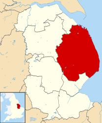
East Lindsey è un distretto del Lincolnshire, Inghilterra, Regno Unito, con sede a Manby.
Il distretto fu creato con il Local Government Act 1972, il 1º aprile 1974 da parte della precedente contea di Lindsey, dalla fusione del municipal borough di Louth con i distretti urbani di Alford, Horncastle, Mablethorpe and Sutton, Skegness e Woodhall Spa con il distretto rurale di Horncastle, il distretto rurale di Louth e il distretto rurale di Spilsby.
Parrocchie civili
|
|
|
Altri progetti
Altri progetti
- Wikimedia Commons
 Wikimedia Commons contiene immagini o altri file su East Lindsey
Collegamenti esterni
- Sito ufficiale, su e-lindsey.gov.uk.

- (EN) East Lindsey, su Enciclopedia Britannica, Encyclopædia Britannica, Inc.

V · D · M | ||
|---|---|---|
| Autorità unitarie | North East Lincolnshire · North Lincolnshire |  |
| Distretti o Borough | Boston · East Lindsey · Lincoln · North Kesteven · South Holland · South Kesteven · West Lindsey | |
| Città e paesi | Alford · Barton-upon-Humber · Boston · Bourne · Brigg · Broughton · Burgh le Marsh · Caistor · Cleethorpes · Crowland · Crowle · The Deepings · Epworth · Gainsborough · Grantham · Grimsby · Holbeach · Horncastle · Immingham · Kirton-in-Lindsey · Lincoln · Long Sutton · Louth · Mablethorpe · Market Deeping · North Hykeham · Scunthorpe · Skegness · Sleaford · Spalding · Spilsby · Stamford · Wainfleet All Saints · Wragby | |
| Parrocchie civili del Lincolnshire | ||


