District de Rangareddy

Cet article est une ébauche concernant l’Inde.
Vous pouvez partager vos connaissances en l’améliorant (comment ?) selon les recommandations des projets correspondants.
| District de Rangareddy రంగా రెడ్డి జిల్లా | ||
 | ||
| Administration | ||
|---|---|---|
| Pays |  Inde Inde | |
| État | Telangana | |
| Chef-lieu | Hyderabad | |
| Fuseau horaire | IST (UTC+5:30) | |
| Démographie | ||
| Population | 5 296 741 hab. (2011[1]) | |
| Densité | 707 hab./km2 | |
| Géographie | ||
| Coordonnées | 17° 12′ nord, 78° 17′ est | |
| Superficie | 749 300 ha = 7 493 km2 | |
| Localisation | ||
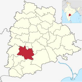 | ||
| Géolocalisation sur la carte : Inde
| ||
| Liens | ||
| Site web | http://rangareddy.ap.nic.in/ | |
modifier  | ||


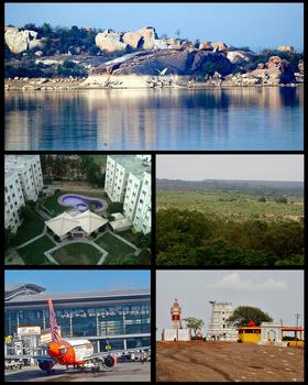
Le district de Rangareddy (télougou : రంగా రెడ్డి జిల్లా) est un district de l'état du Télangana.
Géographie
Son chef-lieu est Hyderabad. Au recensement de 2011, sa population était de 5 296 741 habitants[1] pour une superficie de 7 493 km2[1].
Liens externes
Sur les autres projets Wikimedia :
- District de Rangareddy, sur Wikimedia Commons
- Site officiel
Liens internes
Références
 Portail de l’Inde


