Zogno
Comune in Lombardy, Italy

Coat of arms
Location of Zogno

45°48′N 9°40′E / 45.800°N 9.667°E / 45.800; 9.667
(30 November 2017)[2]
24019
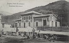
Zogno (Bergamasque: Dógn) is a comune (municipality) in the Province of Bergamo in the Italian region of Lombardy, located about 50 kilometres (31 mi) northeast of Milan and about 11 kilometres (7 mi) north of Bergamo.
Zogno borders the following municipalities: Algua, Alzano Lombardo, Bracca, Brembilla, Costa di Serina, Nembro, Ponteranica, San Pellegrino Terme, Sedrina, Sorisole.
Among the sites in the church are the 17th century church of San Lorenzo Martire and the modern-style church of the Santuario di Maria Santissima Regina.
References
External links
- http://www.comune.zogno.bg.it/
- v
- t
- e
- Adrara San Martino
- Adrara San Rocco
- Albano Sant'Alessandro
- Albino
- Algua
- Almenno San Bartolomeo
- Almenno San Salvatore
- Almè
- Alzano Lombardo
- Ambivere
- Antegnate
- Arcene
- Ardesio
- Arzago d'Adda
- Averara
- Aviatico
- Azzano San Paolo
- Azzone
- Bagnatica
- Barbata
- Bariano
- Barzana
- Bedulita
- Berbenno
- Bergamo
- Berzo San Fermo
- Bianzano
- Blello
- Bolgare
- Boltiere
- Bonate Sopra
- Bonate Sotto
- Borgo di Terzo
- Bossico
- Bottanuco
- Bracca
- Branzi
- Brembate
- Brembate di Sopra
- Brignano Gera d'Adda
- Brumano
- Brusaporto
- Calcinate
- Calcio
- Calusco d'Adda
- Calvenzano
- Camerata Cornello
- Canonica d'Adda
- Capizzone
- Capriate San Gervasio
- Caprino Bergamasco
- Caravaggio
- Carobbio degli Angeli
- Carona
- Carvico
- Casazza
- Casirate d'Adda
- Casnigo
- Cassiglio
- Castel Rozzone
- Castelli Calepio
- Castione della Presolana
- Castro
- Cavernago
- Cazzano Sant'Andrea
- Cenate Sopra
- Cenate Sotto
- Cene
- Cerete
- Chignolo d'Isola
- Chiuduno
- Cisano Bergamasco
- Ciserano
- Cividate al Piano
- Clusone
- Colere
- Cologno al Serio
- Colzate
- Comun Nuovo
- Corna Imagna
- Cornalba
- Cortenuova
- Costa di Mezzate
- Costa Serina
- Costa Valle Imagna
- Costa Volpino
- Covo
- Credaro
- Curno
- Cusio
- Dalmine
- Dossena
- Endine Gaiano
- Entratico
- Fara Gera d'Adda
- Fara Olivana con Sola
- Filago
- Fino del Monte
- Fiorano al Serio
- Fontanella
- Fonteno
- Foppolo
- Foresto Sparso
- Fornovo San Giovanni
- Fuipiano Valle Imagna
- Gandellino
- Gandino
- Gandosso
- Gaverina Terme
- Gazzaniga
- Ghisalba
- Gorlago
- Gorle
- Gorno
- Grassobbio
- Gromo
- Grone
- Grumello del Monte
- Isola di Fondra
- Isso
- Lallio
- Leffe
- Lenna
- Levate
- Locatello
- Lovere
- Lurano
- Luzzana
- Madone
- Mapello
- Martinengo
- Medolago
- Mezzoldo
- Misano di Gera d'Adda
- Moio de' Calvi
- Monasterolo del Castello
- Montello
- Morengo
- Mornico al Serio
- Mozzanica
- Mozzo
- Nembro
- Olmo al Brembo
- Oltre il Colle
- Oltressenda Alta
- Oneta
- Onore
- Orio al Serio
- Ornica
- Osio Sopra
- Osio Sotto
- Pagazzano
- Paladina
- Palazzago
- Palosco
- Parre
- Parzanica
- Pedrengo
- Peia
- Pianico
- Piario
- Piazza Brembana
- Piazzatorre
- Piazzolo
- Pognano
- Ponte Nossa
- Ponte San Pietro
- Ponteranica
- Pontida
- Pontirolo Nuovo
- Pradalunga
- Predore
- Premolo
- Presezzo
- Pumenengo
- Ranica
- Ranzanico
- Riva di Solto
- Rogno
- Romano di Lombardia
- Roncobello
- Roncola
- Rota d'Imagna
- Rovetta
- San Giovanni Bianco
- San Paolo d'Argon
- San Pellegrino Terme
- Sant'Omobono Terme
- Santa Brigida
- Sarnico
- Scanzorosciate
- Schilpario
- Sedrina
- Selvino
- Seriate
- Serina
- Solto Collina
- Solza
- Songavazzo
- Sorisole
- Sotto il Monte Giovanni XXIII
- Sovere
- Spinone al Lago
- Spirano
- Stezzano
- Strozza
- Suisio
- Taleggio
- Tavernola Bergamasca
- Telgate
- Terno d'Isola
- Torre Boldone
- Torre Pallavicina
- Torre de' Busi
- Torre de' Roveri
- Trescore Balneario
- Treviglio
- Treviolo
- Ubiale Clanezzo
- Urgnano
- Valbondione
- Val Brembilla
- Valbrembo
- Valgoglio
- Valleve
- Valnegra
- Valtorta
- Vedeseta
- Verdellino
- Verdello
- Vertova
- Viadanica
- Vigano San Martino
- Vigolo
- Villa d'Adda
- Villa d'Almè
- Villa d'Ogna
- Villa di Serio
- Villongo
- Vilminore di Scalve
- Zandobbio
- Zanica
- Zogno
Authority control databases | |
|---|---|
| International |
|
| Geographic |
|
 | This article on a location in the Province of Bergamo is a stub. You can help Wikipedia by expanding it. |
- v
- t
- e


