Vandeventer, St. Louis
Neighborhood of St. Louis in Missouri, United States
Vandeventer | |
|---|---|
Neighborhood of St. Louis | |
 Houses on Cook Avenue, Vandeventer, August 2011 | |
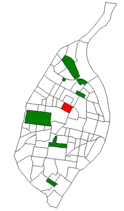 Location (red) of Vandeventer within St. Louis | |
| Country | United States |
| State | Missouri |
| City | St. Louis |
| Wards | 4, 18, 19 |
| Area | |
| • Total | 0.47 sq mi (1.2 km2) |
| Population (2020)[1] | |
| • Total | 2,041 |
| • Density | 4,300/sq mi (1,700/km2) |
| ZIP code(s) | Parts of 63106, 63113 |
| Area code(s) | 314 |
| Website | stlouis-mo.gov |
Vandeventer is a neighborhood of St. Louis, Missouri. The area is bounded by Dr. Martin Luther King Drive on the North, Delmar Boulevard on the South, Vandeventer Avenue on the East, and Newstead Avenue on the West.[2]
History
The founder, Peter Lewis Vandeventer, came to St. Louis in the 1860s with brothers William and Henry Barnum Vandeventer. Peter Lewis Vandeventer and Henry Barnum Vandeventer were Wall Street stockbrokers with a firm located at 6 Wall St., New York City. They made their money from selling stocks and took the train west to St. Louis to invest it inland.
Peter Lewis Vandeventer died in 1879, during the development of Vandeventer Place, a gated, luxurious private place in the neighborhood with stately mansions and a beautiful fountain as its centerpiece. His Missouri estate was managed by several corrupt lawyers, who stole much of the money from the sale of the lots at Vandeventer Place. His family remained in St. Louis for some time after his death, living in Vandeventer Place in a large mansion.
Vandeventer Place met with its demise in 1947, when the eastern half was demolished for the Veterans' Administration's new hospital. The western portion was demolished about ten years later, when the City acquired it as the site for a children's detention home. The fountain and east gates survive in Forest Park.
Demographics
In 2020 Vandeventer's racial makeup was 88.9% black, 4.8% white, 0.5% Asian, 0.4% American Indian, 3.9% two or more races, and 0.5% some other race. 1.9% of the people were of Hispanic or Latino origin.[3]
| Year | Pop. | ±% |
|---|---|---|
| 1990 | 3,480 | — |
| 2000 | 2,209 | −36.5% |
| 2010 | 1,682 | −23.9% |
| 2020 | 2,041 | +21.3% |
| [4] | ||
References
- v
- t
- e
- Academy
- Baden
- Benton Park
- Benton Park West
- Bevo Mill
- Botanical Heights
- Boulevard Heights
- Carondelet
- Carr Square
- Central West End
- Cheltenham
- Chinatown (defunct since 1966)
- Clayton/Tamm
- Clifton Heights
- College Hill
- Columbus Square
- Compton Heights
- Covenant Blu Grand Center
- DeBaliviere Place
- "Dogtown"
- Downtown
- Downtown West
- Dutchtown
- Ellendale
- Fairground
- Forest Park Southeast
- Fountain Park
- Fox Park
- Franz Park
- Gate District
- Gravois Park
- Greater Ville
- Hamilton Heights
- The Hill
- Hi-Pointe
- Holly Hills
- Hyde Park
- JeffVanderLou
- Kings Oak
- Kingsway East
- Kingsway West
- Kosciusko
- Lafayette Square
- LaSalle Park
- Lewis Place
- Lindenwood Park
- Marine Villa
- Mark Twain
- Mark Twain/I-70 Industrial
- McKinley Heights
- Midtown
- Mill Creek Valley (defunct since 1960s)
- Mount Pleasant
- Near North Riverfront
- Northampton
- North Point
- North Riverfront
- O'Fallon
- Old North St. Louis
- Patch
- Peabody–Darst–Webbe
- Penrose
- Princeton Heights
- Riverview
- Shaw
- Skinker DeBaliviere
- Soulard
- Southampton
- Southwest Garden
- St. Louis Hills
- St. Louis Place
- Tiffany
- Tower Grove East
- Tower Grove South
- Vandeventer
- The Ville
- Visitation Park
- Walnut Park East
- Walnut Park West
- Wells/Goodfellow
- West End
- Wydown/Skinker
38°39′01″N 90°14′35″W / 38.6502°N 90.2430°W / 38.6502; -90.2430
 | This St. Louis location article is a stub. You can help Wikipedia by expanding it. |
- v
- t
- e


