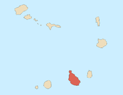
Tarrafal, Cape Verde (municipality)
Tarrafal is a concelho (municipality) of Cape Verde. It is situated in the northern part of the island of Santiago. Its seat is the town Tarrafal. Its population was 18,565 at the 2010 census, and its area is 120.8 km2.[2]


Subdivisions
The municipality consists of one freguesia (civil parish), Santo Amaro Abade. The freguesia is subdivided into the following settlements (population data from the 2010 census):[1]
- Achada Biscanhos (pop: 310)
- Achada Lagoa (pop: 64)
- Achada Longueira (pop: 520)
- Achada Meio (pop: 211)
- Achada Moirão (pop: 587)
- Achada Tenda (pop: 1,242, town)[3]
- Biscainhos (pop: 695)
- Chão Bom (pop: 5,166)
- Curral Velho (pop: 358)
- Fazenda (pop: 107)
- Figueira Muita (pop: 160)
- Lagoa (pop: 55)
- Mato Brasil (pop: 160)
- Mato Mendes (pop: 194)
- Milho Branco (pop: 165)
- Ponta Lobrão (pop: 435)
- Ribeira da Prata (pop: 1,009, town)[3]
- Tarrafal (pop: 6,656, city)[3]
- Trás os Montes (pop: 464)
History
The municipality was created in 1917, when two northern parishes of the older Municipality of Santa Catarina were split off to become the Municipality of Tarrafal. In 1997, the southeastern part of the municipality was split off to become the Municipality of São Miguel.[4] Under Salazar the Tarrafal Concentration Camp was built on the plain south of town (Chão Bom) to contain opponents of the political regime.
Demography
| Year | Population |
|---|---|
| 1940[5][6] | 18,840 |
| 1950[5][6] | 13,222 |
| 1960[5][6] | 19,140 |
| 1970[5][6] | 26,251 |
| 1980[5][6] | 24,202 |
| 1990[5] | 11,626 |
| 2000[5] | 18,059 |
| 2010[2] | 18,565 |
Politics
At the federal level, it belongs to the constituency of Santiago North. Since 2004, the Movement for Democracy (MpD) is the ruling party of the municipality. The results of the latest elections, in 2016:[7]
| Party | Municipal Council | Municipal Assembly | ||
|---|---|---|---|---|
| Votes% | Seats | Votes% | Seats | |
| MpD | 53.70 | 7 | 54.22 | 10 |
| PAICV | 43.11 | 0 | 42.54 | 7 |
Notable people
- Pany Varela, futsal player
- Pedro Celestino Silva Soares, footballer (soccer player)
- Silvino Lopes Évora, writer
- Mário Lúcio de Sousa, singer, member of the band Simentera
- Janício Martins, footballer (soccer player)
International relations
Tarrafal is twinned with the following municipalities in Portugal:[8]
References

- ^ a b "2010 Census results". Instituto Nacional de Estatística Cabo Verde (in Portuguese). 24 November 2016.
- ^ a b 2010 Census Summary
- ^ a b c Cabo Verde, Statistical Yearbook 2015, Instituto Nacional de Estatística, p. 32-33
- ^ História Câmara municipal, Câmara municipal do Tarrafal
- ^ a b c d e f g Statoids
- ^ a b c d e Includes the population of the present-day São Miguel municipality.
- ^ Official results local elections 2016, Boletim Oficial I Série, Número 53, 23 September 2016
- ^ Geminações de Cidades e Vilas
External links
- Câmara Municipal do Tarrafal
- ANMCV (Associação Nacional dos Municípios Cabo-Verdianos - National Association of the Capeverdean Municipalities)
- v
- t
- e
- Boa Vista
- Paul
- Porto Novo
- Ribeira Brava
- Ribeira Grande
- Sal
- São Vicente
- Tarrafal de São Nicolau
- Brava
- Maio
- Mosteiros
- Praia
- Ribeira Grande de Santiago
- Santa Catarina
- Santa Catarina do Fogo
- Santa Cruz
- São Domingos
- São Filipe
- São Lourenço dos Órgãos
- São Miguel
- São Salvador do Mundo
- Tarrafal


