Taquarussu, Mato Grosso do Sul
Municipality in Central-West, Brazil

Flag

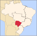
Location in Mato Grosso do Sul state
(2020 [1])
Taquarussu is a municipality located in the Brazilian state of Mato Grosso do Sul. Its population was 3,588 (2020) and its area is 1,041 km².
The municipality contains 21% of the 73,345 hectares (181,240 acres) Rio Ivinhema State Park, created in 1998.[2]
References
- v
- t
- e

Capital: Campo Grande
Centro Norte de Mato Grosso do Sul
| Alto Taquari |
|
|---|---|
| Campo Grande |
|
Leste de Mato Grosso do Sul
| Cassilândia | |
|---|---|
| Nova Andradina |
|
| Paranaíba | |
| Três Lagoas |
Pantanal Sul Mato-Grossense
| Aquidauana | |
|---|---|
| Baixo Pantanal |
Sudoeste de Mato Grosso do Sul
| Bodoquena | |
|---|---|
| Dourados | |
| Iguatemi |
 | This Mato Grosso do Sul, Brazil location article is a stub. You can help Wikipedia by expanding it. |
- v
- t
- e


