Schwarzenfeld
Municipality in Bavaria, Germany

Coat of arms
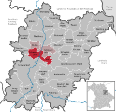
Location of Schwarzenfeld within Schwandorf district
(2020–26) Peter Neumeier[1] (FW)
(2022-12-31)[2]
92521
Schwarzenfeld is a municipality in the district of Schwandorf in Bavaria, Germany.
The melodic death metal band Deadlock is based in this municipality.
Climate
| ||||||||||||||||||||||||||||||||||||||||||||||||||||||||||||||||||||||||||||||||||||||||||||||||||||||||||||||||||||||||||||
Notable buildings

References
- ^ Liste der ersten Bürgermeister/Oberbürgermeister in kreisangehörigen Gemeinden, Bayerisches Landesamt für Statistik, 15 July 2021.
- ^ Genesis Online-Datenbank des Bayerischen Landesamtes für Statistik Tabelle 12411-003r Fortschreibung des Bevölkerungsstandes: Gemeinden, Stichtag (Einwohnerzahlen auf Grundlage des Zensus 2011).
- ^ "NASA Earth Observations Data Set Index". NASA. Retrieved 30 January 2016.
- v
- t
- e
Towns and municipalities in Schwandorf (district)
- Altendorf
- Bodenwöhr
- Bruck in der Oberpfalz
- Burglengenfeld
- Dieterskirchen
- Fensterbach
- Gleiritsch
- Guteneck
- Maxhütte-Haidhof
- Nabburg
- Neukirchen-Balbini
- Neunburg vorm Wald
- Niedermurach
- Nittenau
- Oberviechtach
- Pfreimd
- Schmidgaden
- Schönsee
- Schwandorf
- Schwarzach bei Nabburg
- Schwarzenfeld
- Schwarzhofen
- Stadlern
- Steinberg am See
- Stulln
- Teublitz
- Teunz
- Thanstein
- Trausnitz
- Wackersdorf
- Weiding
- Wernberg-Köblitz
- Winklarn

Authority control databases | |
|---|---|
| International |
|
| National |
|
 | This Schwandorf district location article is a stub. You can help Wikipedia by expanding it. |
- v
- t
- e


