Santee Sioux Reservation
Indian reservation in United States, Santee Sioux Nation
Santee Sioux Reservation Isáŋyathi (Dakota) | |
|---|---|
Indian reservation | |
 Seal | |
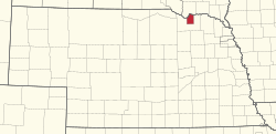 Location in Nebraska | |
| Tribe | Santee Sioux Nation |
| Country | United States |
| State | Nebraska |
| County | Knox |
| Headquarters | Niobrara |
| Government | |
| • Body | Tribal Council |
| • Chairman | Roger Trudell |
| • Vice-Chairman | Sidney Tuttle |
| Area | |
| • Total | 172.99 sq mi (448.0 km2) |
| Population (2017)[2] | |
| • Total | 1,041 |
| • Density | 6.0/sq mi (2.3/km2) |
| Website | santeesiouxnation.net |

The Santee Sioux Reservation (Dakota: Isáŋyathi) of the Santee Sioux (also known as the Eastern Dakota) was established in 1863 in present-day Nebraska. The tribal seat of government is located in Niobrara, Nebraska, with reservation lands in Knox County.
History
Established by an Act of the U.S. Congress on March 3, 1863, the Niobrara Reservation was officially recognized in an Executive Order dated February 27, 1866, and in treaties dated November 16, 1867 and April 29, 1868. Additional executive orders applying to the reservation were dated August 31, 1869, December 31, 1873, and February 9, 1885. In those initial years, tribal members selected 32,875.75 acres (133.0434 km2) as homesteads and 38,908.01 acres (157.4551 km2) as allotments; 1,130.70 acres (4.5758 km2) were designated for use as an Indian agency, school, and mission.[3]
The reservation (shown as Dakota Reservation on the map at right) lies along the south bank of the Missouri River, and includes part of Lewis and Clark Lake. As of the 2000 census, the reservation recorded a resident population of 878, of which 64.1% were Native American and 33.7% White. Its land area is 172.99 mi.² (447.84 km2). The major center of population is the village of Santee, in the northernmost portion of the reservation.[4]
Other major populations of Oglala Lakota and Brulé Sioux are located to the north on reservations within South Dakota.
Government
Chief Wabasha was the first and last head chief of the Santee Sioux until his death in 1876. The first tribal council election was held on January 22, 1878, following a unanimous vote to end the old chief system.[5]
Communities
See also
- Native American tribes in Nebraska
- Sioux
- Wabasha III, head chief of Santee Sioux
- John Trudell, activist, poet, actor, and musician whose father was Santee Dakota and who grew up near the Santee Sioux Reservation
References
- ^ "tribal government". Retrieved 2019-07-24.
- ^ 2013-2017 American Community Survey 5-Year Estimates. "My Tribal Area". United States Census Bureau.
{{cite web}}: CS1 maint: numeric names: authors list (link) - ^ Santee Sioux, Nebraska Indian Commission. Retrieved 6/28/08.
- ^ (2005) "Information background sheet", U.S. Department of the Interior, Bureau of Reclamation. Retrieved 11/29/08.
- ^ Meyer, Roy Willard (1967). History of the Santee Sioux. Lincoln: University of Nebraska Press. p. 169. ISBN 9780803281097.
External links
- Official reservation homepage.
- Reservation tract map from the US Census.
- Santee Normal Training School, Woonspe Wankantu, 1881, 1882, 1884, 1885 from the American Board of Commissioners for Foreign Missions.
42°43′35″N 97°49′49″W / 42.72639°N 97.83028°W / 42.72639; -97.83028
- v
- t
- e

- Ioway
- Omaha
- Ponca
- Sac and Fox
- Santee Sioux
- Winnebago
colleges and universities
- Ton'wontongathon
- Pike-Pawnee Village Site
- Skidi Pawnee Village
- Horse Creek Pawnee Village
- Cottonwood Creek
- Schrader Archeological Site
- Fullerton Archeological Site
- Oto Indian Village Site
- Leshara Site
- McClean Site
- Woodcliff Site
- Theodore Davis Site
- Kelso Site
- Wright Site
- Pahur
- Ahkawitakol
- Lalawakohtito
- Pahuk
- Cunningham Archeological Site
- Blackbird Hill
- Genoa Indian Industrial School
- Dr. Susan LaFlesche Picotte Memorial Hospital
- Indian agencies
- Susan LaFlesche Picotte House
- Nanza
- Moses Merrill Mission
- Pawnee Mission and Burnt Village Archeological Site
- Carlisle Indian Industrial School
- Ionia Volcano
- Leary Site
- Ash Hollow
- Coufal
- Schultz site
- Signal Butte
- Site 25SM20
- Champe-Fremont 1 Archeological Site
- Frank Parker Archeological Site
- Sweetwater Archeological Site
- Burkett Archeological Site
- Ashland Archeological Site
- Yutan Site
- Schrader Archeological Site
- Humphrey Archeological Site
- Table Rock Archeological Site
- Indian Cave
- Indian Hill
- Walker Gilmore site
- Site JF00-072
- Hudson-Meng Bison Kill
- Woodcliff Burials
- Nehawka Flint Quarries
- Farwell Archeological District
- Blue Springs, aka Wonder Site
- Barneston Site
- Kurz Omaha Village Site
- Patterson Site
- Fontenelle Forest Historic District
- Wolfe and Grey (Schuyler) Sites
- Schulte Archeological Site
- Wiseman Archeological Site
- Durflinger Site
Municipalities and communities of Knox County, Nebraska, United States | ||
|---|---|---|
County seat: Center | ||
| Cities |  | |
| Villages | ||
| Townships | ||
| CDP | ||
| Unincorporated communities | ||
| Indian reservations |
| |
| ||
Authority control databases | |
|---|---|
| International |
|
| National |
|
 | This Knox County, Nebraska state location article is a stub. You can help Wikipedia by expanding it. |
- v
- t
- e
 | This article relating to the Indigenous peoples of North America is a stub. You can help Wikipedia by expanding it. |
- v
- t
- e


