Sìn Hồ district
You can help expand this article with text translated from the corresponding article in Vietnamese. (March 2009) Click [show] for important translation instructions.
- View a machine-translated version of the Vietnamese article.
- Machine translation, like DeepL or Google Translate, is a useful starting point for translations, but translators must revise errors as necessary and confirm that the translation is accurate, rather than simply copy-pasting machine-translated text into the English Wikipedia.
- Do not translate text that appears unreliable or low-quality. If possible, verify the text with references provided in the foreign-language article.
- You must provide copyright attribution in the edit summary accompanying your translation by providing an interlanguage link to the source of your translation. A model attribution edit summary is
Content in this edit is translated from the existing Vietnamese Wikipedia article at [[:vi:Sìn Hồ]]; see its history for attribution. - You may also add the template
{{Translated|vi|Sìn Hồ}}to the talk page. - For more guidance, see Wikipedia:Translation.
District in Northwest, Vietnam
Sìn Hồ District Huyện Sìn Hồ | |
|---|---|
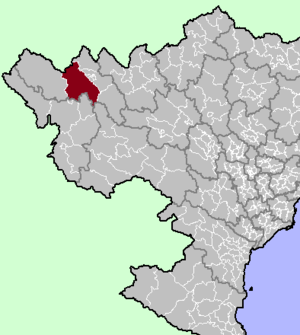 District location in northern Vietnam | |
| Country |  Vietnam Vietnam |
| Region | Northwest |
| Province | Lai Châu |
| Capital | Sìn Hồ |
| Area | |
| • Total | 1,526.96 km2 (589.56 sq mi) |
| Population (2019)[1] | |
| • Total | 83,643 |
| • Density | 55/km2 (140/sq mi) |
| Time zone | UTC+7 (Indochina Time) |
Sìn Hồ is a rural district of Lai Châu province in the Northwest region of Vietnam. There are various ethnic minorities of people such as the Mong and Dao.
As of 2019, the district had a population of 83,643.[1] The district covers an area of 1,526.96 km². The district capital lies at Sìn Hồ.[2]
The district is subdivided to 22 commune-level subdivisions, including Sìn Hồ township and the rural communes of Căn Co, Chăn Nưa, Hồng Thu, Làng Mô, Lùng Thàng, Ma Quai, Nậm Cha, Nậm Cuổi, Nậm Hăn, Nậm Mạ, Nậm Tăm, Noong Hẻo, Pa Khóa, Pa Tần, Phăng Sô Lin, Phìn Hồ, Pu Sam Cáp, Sà Dề Phìn, Tả Ngảo, Tả Phìn and Tủa Sín Chải.
Climate
| Climate data for Sìn Hồ, elevation 1,529 m (5,016 ft) | |||||||||||||
|---|---|---|---|---|---|---|---|---|---|---|---|---|---|
| Month | Jan | Feb | Mar | Apr | May | Jun | Jul | Aug | Sep | Oct | Nov | Dec | Year |
| Mean daily maximum °C (°F) | 14.8 (58.6) | 17.3 (63.1) | 20.8 (69.4) | 23.0 (73.4) | 23.6 (74.5) | 23.4 (74.1) | 23.3 (73.9) | 23.7 (74.7) | 22.9 (73.2) | 20.7 (69.3) | 17.8 (64.0) | 15.0 (59.0) | 20.5 (68.9) |
| Daily mean °C (°F) | 10.2 (50.4) | 12.3 (54.1) | 15.5 (59.9) | 18.0 (64.4) | 19.4 (66.9) | 20.0 (68.0) | 20.0 (68.0) | 19.9 (67.8) | 18.8 (65.8) | 16.5 (61.7) | 13.1 (55.6) | 10.2 (50.4) | 16.2 (61.2) |
| Mean daily minimum °C (°F) | 6.9 (44.4) | 8.6 (47.5) | 11.3 (52.3) | 14.2 (57.6) | 16.6 (61.9) | 18.0 (64.4) | 18.0 (64.4) | 17.6 (63.7) | 16.1 (61.0) | 13.8 (56.8) | 10.1 (50.2) | 6.9 (44.4) | 13.2 (55.8) |
| Average precipitation mm (inches) | 44.5 (1.75) | 42.1 (1.66) | 76.6 (3.02) | 186.9 (7.36) | 320.0 (12.60) | 501.9 (19.76) | 602.6 (23.72) | 450.4 (17.73) | 247.6 (9.75) | 141.6 (5.57) | 80.5 (3.17) | 44.1 (1.74) | 2,738.7 (107.82) |
| Average rainy days | 8.1 | 8.2 | 8.8 | 14.5 | 21.1 | 26.0 | 26.9 | 24.6 | 18.4 | 13.4 | 9.3 | 6.8 | 186.0 |
| Average relative humidity (%) | 84.9 | 79.7 | 74.5 | 77.8 | 83.4 | 87.8 | 89.1 | 88.7 | 87.5 | 87.6 | 87.8 | 87.0 | 84.6 |
| Mean monthly sunshine hours | 157.5 | 168.3 | 198.7 | 205.2 | 182.0 | 108.1 | 109.9 | 133.5 | 143.0 | 136.8 | 145.0 | 149.7 | 1,840.6 |
| Source: Vietnam Institute for Building Science and Technology[3] | |||||||||||||
References
- ^ a b General Statistics Office of Vietnam (2019). "Completed Results of the 2019 Viet Nam Population and Housing Census" (PDF). Statistical Publishing House (Vietnam). ISBN 978-604-75-1532-5.
- ^ "Districts of Vietnam". Statoids. Retrieved March 13, 2009.
- ^ "Vietnam Institute for Building Science and Technology" (PDF). Retrieved 16 August 2023.
22°15′00″N 103°19′59″E / 22.250°N 103.333°E / 22.250; 103.333
- v
- t
- e
Districts of Northwest Vietnam

※ denotes provincial seat.
 | This article about a location in Lai Châu Province, Vietnam is a stub. You can help Wikipedia by expanding it. |
- v
- t
- e


