Sèvre Niortaise
River in France


• location
• coordinates
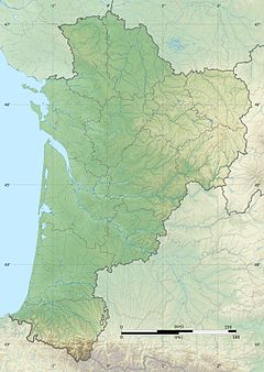
The Sèvre Niortaise (French pronunciation: [sɛvʁ njɔʁtɛz]) is a 158.4 km (98.4 mi) long river in the Nouvelle-Aquitaine and Pays de la Loire regions in western France, flowing into the Atlantic Ocean.[1] Its source is in the Deux-Sèvres department, near Sepvret, north of Melle.
It flows through the following departments and towns:
- Deux-Sèvres: Saint-Maixent-l'École, Niort
- Vendée: Damvix
- Charente-Maritime: Marans
It flows into the Atlantic Ocean in Bourg-Chapon, north of the city of La Rochelle. The largest city along the river is Niort, which gives it the name Sèvre Niortaise, distinguishing it from the Sèvre Nantaise. Its largest tributaries are the Vendée and the Autise.
References
Wikimedia Commons has media related to Sèvre Niortaise.
| Authority control databases |
|
|---|
- v
- t
- e
 | This Nouvelle-Aquitaine geographical article is a stub. You can help Wikipedia by expanding it. |
- v
- t
- e
This article related to a river in France is a stub. You can help Wikipedia by expanding it. |
- v
- t
- e


