Puget Island, Washington
CDP in Washington, United States
46°10′36″N 123°23′1″W / 46.17667°N 123.38361°W / 46.17667; -123.38361 (2020)
98612[1]

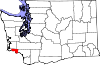
Puget Island is a 7.5 sq mi(4,785 acre; 19.365 km2) island and Census-designated place (CDP) in the Columbia River in Wahkiakum County, Washington, United States. The island was named for Peter Puget, a lieutenant in the Vancouver Expedition of exploration, which first mapped the island in 1792.[2]
The Julia Butler Hansen Bridge (built in 1938) carries State Route 409 across the Cathlamet Channel to connect the island to the town of Cathlamet, Washington. Route 409 crosses the island to its southern shore, where it connects with the county-operated Wahkiakum County Ferry, Oscar B, providing service to Westport, Oregon. The 2020 census reported a population of 922 persons.
Puget Island's Robert W. Little Preserve is home to a population of endangered Columbian white-tailed deer.[3]
Demographics
| Census | Pop. | Note | %± |
|---|---|---|---|
| 2010 | 831 | — | |
| 2020 | 922 | 11.0% | |
| US Decennial Census[4] 2020 Census[5] | |||
As of the 2020 census, there were 922 people, 488 housing units, and 455 families. There were 833 White people, 1 African American, 13 Native Americans, 2 Asians, 7 people from some other race, and 66 people from two or more races. There were 34 people from Hispanic or Latino origin.[6]
The ancestry in Puget Island was 21.5% English, 8.7% German, 7.1% Irish, 4.9% Norwegian,1.8% Scottish, 1.8% French, and 0.9% Italian.[6]
The median age was 60 years old. A total of 37.5% of the population were older than 65, with 22.5% being from 65 to 74 years, 12.7% being from 75 to 84 years, and 2.2% being 85 or older.[6]
The median household income was $56,929, with families having $58,401, and non-families having $56,087. A total of 10.6% of the population were in poverty, with 9.3% of people between the ages of 18 and 64 being in poverty, and 17.4% of people over 65 being in poverty.[6]
References
- ^ "Puget Island WA ZIP Code". zipdatamaps.com. 2023. Retrieved June 16, 2023.
- ^ Majors, Harry M. (1975). Exploring Washington. Van Winkle Publishing Co. p. 114. ISBN 978-0-918664-00-6.
- ^ "The Nature Conservancy: Robert W. Little (Puget Island) Preserve". Archived from the original on September 30, 2007. Retrieved October 29, 2007.
- ^ "US Gazetteer files: 2010, 2000, and 1990". United States Census Bureau. February 12, 2011. Retrieved May 14, 2024.
- ^ "Census Bureau profile: Puget Island, Washington". United States Census Bureau. May 2023. Retrieved May 14, 2024.
- ^ a b c d "Explore Census Data". data.census.gov. Retrieved May 19, 2023.
- Puget Island: Blocks 5001 thru 5025, Census Tract 9501, Wahkiakum County, Washington United States Census Bureau
External links
- Cowlitz-Wahkiakum Council of Governments
- Wahkiakum Ferry, Oscar B
- v
- t
- e
Municipalities and communities of Wahkiakum County, Washington, United States
County seat: Cathlamet
communities
- Washington portal
- United States portal
 | This Wahkiakum County, Washington state location article is a stub. You can help Wikipedia by expanding it. |
- v
- t
- e
 | This article about an island is a stub. You can help Wikipedia by expanding it. |
- v
- t
- e


