Panteg
Human settlement in Wales


Panteg
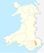
Location within Torfaen
- Panteg
- Torfaen
- Gwent
- Torfaen
- Torfaen

Panteg (Welsh: Pant-teg) is a large village and community in the county borough of Torfaen, Wales. It is adjacent to Griffithstown, between the towns of Cwmbran and Pontypool. The village is best known for Panteg Steel Works, which closed in 2004.[3]
Prior to 1935 Panteg was also an urban district. It had a population of 11,499 in 1931. It was amalgamated into Pontypool in 1935.[4] It is now a community and electoral ward of Torfaen.
Notable people
- See Category:People from Panteg
- Edwin Stevens inventor and philanthropist
- Herbert Armitage James, who was Headmaster of Rugby School and later President of St John's College, Oxford, grew up in Panteg and is commemorated by a memorial in the parish church, where his father was rector from 1856 to 1871.
- Edward Thomas Chapman, winner of the Victoria Cross in the Second World War is buried in Panteg cemetery which is located a few miles from St Mary's church.
- Ian Gough, Ryan Powell and Lloyd Burns, Wales rugby union international players.
- Steve Parry, avant-garde guitarist and founder of Hwyl Nofio was born and lived in Panteg.
See also
 Wales portal

- County Hospital, often referred to as Panteg Hospital
- Panteg cemetery
- Panteg and Griffithstown railway station
References
- ^ "2011 Census:Quick Statistics:Population Density for Panteg". Office for National Statistics. Retrieved 29 November 2013.
- ^ "2011 Census:Key Statistics:Key Figures for Panteg". Office for National Statistics. Retrieved 25 November 2013.
- ^ "End of an era for steelworks". Archived from the original on 6 January 2009. Retrieved 15 August 2009.
- ^ Columbia-Lippincott Gazetteer. 1952 Edition. p. 1424
- v
- t
- e
- Abersychan
- Blaenavon
- Brynwern
- Coed Eva
- Croesyceiliog North
- Croesyceiliog South
- Cwmynyscoy
- Fairwater
- Greenmeadow
- Llantarnam
- Llanyrafon North
- Llanyrafon South
- New Inn
- Panteg
- Pontnewydd
- Pontnewynydd
- Pontypool
- Snatchwood
- St Cadocs/Penygarn
- St Dials
- Trevethin
- Two Locks
- Upper Cwmbran
- Wainfelin
 Geography
 Wales
Wales


 | This Torfaen location article is a stub. You can help Wikipedia by expanding it. |
- v
- t
- e


