Mount Saint Elias
Mountain in Alaska and the Yukon Territory on the United States–Canada border


Mount Saint Elias
Location on Alaska/Yukon border
Show map of Alaska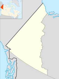
Mount Saint Elias
Mount Saint Elias (Yukon)
Show map of YukonNTS 115C7 Newton Glacier
Mount Saint Elias (Was'eitushaa also designated Boundary Peak 186),[2][3] the second-highest mountain in both Canada and the United States, stands on the Yukon and Alaska border about 26 miles (42 km) southwest of Mount Logan,[4] the highest mountain in Canada. The Canadian side of Mount Saint Elias forms part of Kluane National Park and Reserve, while the U.S. side of the mountain is located within Wrangell-St. Elias National Park and Preserve.
History and features

The name of the mountain in Tlingit, Yasʼéitʼaa Shaa or Was'eitushaa, means "mountain behind Icy Bay"; the Yakutat Tlingit occasionally call it Shaa Tlein "Big Mountain". It is one of the most important crests of the Kwaashkʼiḵwáan clan, who used it as a guide during their journey down the Copper River.[4] Mount Fairweather at the apex of the British Columbia and Alaska borders at the head of the Alaska Panhandle is known as Tsalx̱aan; legend states that this mountain and Yasʼéitʼaa Shaa (Mt. St. Elias) originally stood next to each other, but had an argument and separated. Their children, the mountains in between the two peaks, are called Tsalx̱aan Yátxʼi ("Children of Tsalxaan").
European explorers first sighted the mountain on July 16, 1741, with the arrival of the expedition commanded by Vitus Bering, a Danish explorer in service of Russia. While some historians contend that Bering named the mountain, others believe that eighteenth-century mapmakers named it after Cape Saint Elias when Bering left the peak unnamed.[2]
Mount Saint Elias is notable for its immense vertical relief. Its summit rises 18,008 feet (5,489 m) vertically in just 10 miles (16 km) horizontal distance from the head of Taan Fjord, off of Icy Bay.
In 2007 Gerald Salmina directed an Austrian documentary film, Mount St. Elias, about a team of skier/mountaineers determined to make "the planet's longest skiing descent" by ascending the mountain and then skiing nearly all 18,000 feet down to the Gulf of Alaska; the movie finished editing and underwent limited release in 2009. The climbers ended up summiting on the second attempt and skiing down to 13,000 ft (3,960 m).[5]
Climbing history


Mt. St. Elias was first climbed on July 31, 1897, by an Italian expedition led by famed explorer Prince Luigi Amedeo, Duke of the Abruzzi,[6][7] (who also reconnoitered the current standard route on K2 in 1909[8]) and included noted mountain photographer Vittorio Sella.[9]
The second ascent was not until 1946, when a group from the Harvard Mountaineering Club including noted mountain historian Dee Molenaar climbed the Southwest Ridge route. The summit party comprised Molenaar, his brother Cornelius, Andrew and Betty Kauffman, Maynard Miller, William Latady, and Benjamin Ferris. William Putnam was a member of the expedition but did not make the summit. They used eleven camps, eight of which were on the approach from Icy Bay, and three of which were on the mountain. They were supported by multiple air drops of food.[10]
The first winter ascent was made on February 13, 1996, by David Briggs, Gardner Heaton and Joe Reichert. After being flown by pilots Steve Ranney and Gary Graham, in to 2,300 feet (700 m) on the Tyndall Glacier, they climbed the southwest ridge and followed the "Milk Bowl" variation in order to avoid 2,000 feet of loose rock on the normal route. The team had originally planned to begin their ascent from the ocean and cross the Tyndall Glacier but the terrain was in very poor condition.[11]
Mount Saint Elias is infrequently climbed today, despite its height, because it has no easy route to the summit and because of its prolonged periods of bad weather (mainly snow and low visibility).[citation needed]
Routes
- Abruzzi Ridge
- Livermore Ridge
See also
 North America portal
 Alaska portal
 Canada portal
 Mountains portal


- List of mountain peaks of North America
- List of Boundary Peaks of the Alaska-British Columbia/Yukon border
- Mount Newton
- Haydon Peak
References
- ^ a b c "Mount Saint Elias, Alaska-Yukon". Peakbagger.com. Retrieved December 30, 2015.
- ^ a b c "Mount Saint Elias". Geographic Names Information System. United States Geological Survey, United States Department of the Interior. Retrieved 2007-10-31.
- ^ Ramos, Judith Daxootsu; Abraham, Elaine Chewshaa; Cellarius, Barbara. "Mount St. Elias - Was'eitushaa". Wrangell St. Elias National Park and Preserve. US National Park Service. Retrieved 2023-11-13.
- ^ a b "Mount Saint Elias". Bivouac.com. Retrieved 2004-10-01.
- ^ "Mount St. Elias – Official Movie Site". Archived from the original on 2010-08-25. Retrieved 2010-03-10.
- ^ "Naming Alaska's Mountains". Feature Article. American Alpine Journal. American Alpine Club. 1959. Retrieved 2016-12-09.
- ^ "1897 Mount St. Elias". Virtual Museum Canada. Archived from the original on 2011-11-19.
- ^ House, William P. (1939). "K2-1938". Feature Article. American Alpine Journal. American Alpine Club. Retrieved 2016-12-09.
- ^ The Ascent of Mount St. Elias by H. R. H. Prince Luigi Amedeo di Savoia, Duke of the Abruzzi, narrated by Filippo de Filippi, illustrated by Vittorio Sella and translated by Signora Linda Villari with the author's supervision, New York: Frederick A. Stokes company, 1900.
- ^ Miller, Maynard Malcolm (1947). "Yahtsétesha". Feature Article. American Alpine Journal. American Alpine Club: 257–268. Retrieved 2016-12-09.
- ^ "Mount Saint Elias, First Winter Ascent". Climbs And Expeditions. American Alpine Journal. American Alpine Club. 1997. Retrieved 2016-12-09.
Works cited
- Wood, Michael; Cooms, Colby (2001). Alaska: a climbing guide. The Mountaineers.
External links
 Media related to Mount Saint Elias at Wikimedia Commons
Mount Saint Elias at Wikipedia's sister projects
 Definitions from Wiktionary
 Media from Commons
 News from Wikinews
 Quotations from Wikiquote
 Texts from Wikisource
 Textbooks from Wikibooks
 Resources from Wikiversity
- "Mount Saint Elias". Peakware.com. Archived from the original on 2016-03-04.
- v
- t
- e
- Denali
- Mount Logan
- Pico de Orizaba
- Mount Saint Elias
- Volcán Popocatépetl
- Mount Foraker
- Mount Lucania
- Volcán Iztaccíhuatl
- King Peak
- Mount Bona
- Mount Steele
- Mount Blackburn
- Mount Sanford
- Mount Wood
- Mount Vancouver
- Mount Slaggard
- Nevado de Toluca
- Mount Fairweather
- Sierra Negra
- Mount Hubbard
- Mount Bear
- Mount Walsh
- Mount Hunter
- Volcán La Malinche
- Mount Whitney
- Mount Alverstone
- University Peak
- Mount Elbert
- Mount Massive
- Mount Harvard
- Mount Rainier
- Mount Williamson
- McArthur Peak
- Blanca Peak
- La Plata Peak
- Uncompahgre Peak
- Crestone Peak
- Mount Lincoln
- Castle Peak
- Grays Peak
- Mount Antero
- Mount Blue Sky
- Longs Peak
- Mount Wilson
- White Mountain Peak
- North Palisade
- Mount Princeton
- Mount Yale
- Mount Shasta
- Maroon Peak
- Mount Wrangell
- Mount Sneffels
- Capitol Peak
- Pikes Peak
- Windom Peak/Mount Eolus
- Mount Augusta
- Handies Peak
- Culebra Peak
- Cofre de Perote
- San Luis Peak
- Mount of the Holy Cross
- Nevado de Colima
- Grizzly Peak
- Mount Humphreys
- Mount Keith
- Mount Strickland
- Mount Ouray
- Vermilion Peak
- Avalanche Peak
- Atna Peaks
- Volcán Tajumulco
- Regal Mountain
- Mount Darwin
- Mount Hayes
- Mount Silverheels
- Rio Grande Pyramid
- Gannett Peak
- Mount Kaweah
- Grand Teton
- Mount Cook
- Mount Morgan
- Mount Gabb
- Bald Mountain
- Mount Oso
- Mount Jackson
- Mount Tom
- Bard Peak
- Cerro Tláloc
- West Spanish Peak
- Mount Powell
- Hagues Peak
- Mount Dubois
- Tower Mountain
- Treasure Mountain
- Kings Peak
- North Arapaho Peak
- Mount Pinchot
- Mount Natazhat
- Mount Jarvis
- Parry Peak
- Bill Williams Peak
- Sultan Mountain
- Mount Herard
- Volcán Tacaná
- West Buffalo Peak
- Mount Craig
- Tressider Peak
- Summit Peak
- Middle Peak/Dolores Peak
- Antora Peak
- Henry Mountain
- Hesperus Mountain
- Mount Silverthrone
- Jacque Peak
- Bennett Peak
- Wind River Peak
- Mount Waddington
- Conejos Peak
- Mount Marcus Baker
- Cloud Peak
- Wheeler Peak
- Francs Peak
- Twilight Peak
- South River Peak
- Mount Ritter
- Red Slate Mountain

Subdivisions of Yukon | |
|---|---|
| Municipalities | |
| Unorganized areas | |
| Communities (unincorporated) |
|
| Ghost towns | |
| Parks | |
| Regions | |
| |


Authority control databases | |
|---|---|
| International |
|
| National |
|


