Millersville, Ohio
Unincorporated community in Ohio, U.S.
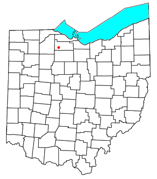
Millersville is an unincorporated community in northwestern Jackson Township, Sandusky County, Ohio, United States,[1] within the Toledo Metropolitan Area. It lies at the intersection of Millersville Road and the Greensburg Pike. Muddy Creek, which flows into Sandusky Bay near the mouth of the Sandusky River, flows past the community.[2] The community is served by the Helena (43435) post office.
History
Millersburg had its start when the Pittsburgh, Fort Wayne & Chicago Railroad was extended to that point.[3] A post office called Millersville has been in operation since 1873.[4] Peter Miller, the first postmaster, gave the community its name.[5]
References
- ^ U.S. Geological Survey Geographic Names Information System: Millersville, Ohio
- ^ DeLorme, Ohio Atlas & Gazetteer, 5th ed., Yarmouth, Maine, 1999, pp. 37-38. ISBN 0-89933-270-6
- ^ Everett, Homer (1882). History of Sandusky County, Ohio: With Portraits and Biographies. H. Z. Williams & Bro. p. 757.
- ^ "Sandusky County". Jim Forte Postal History. Retrieved December 28, 2015.
- ^ Meek, Basil (1909). Twentieth Century History of Sandusky County, Ohio and Representative Citizens. Whipporwill Publications. pp. 322.
- v
- t
- e
Toledo, Ohio and suburbs
- TARTA
- Toledo Express Airport
- Executive Airport
- Suburban Airport
- Martin Luther King Jr. Plaza (train / intercity bus)
- Arboretum
- Art Museum
- Botanical Garden
- Cathedral
- Fort Meigs
- Hollywood Casino
- Imagination Station
- Library
- Lighthouse
- Maumee Bay
- Metroparks Toledo
- National Museum of the Great Lakes
- Oliver House
- One SeaGate
- Opera
- Sculpture in the Park
- Stranahan Theater
- Tony Packo's Cafe
- Symphony Orchestra
- Yacht Club
- Zoo
- Franklin Park Mall
- The Shops at Fallen Timbers
- Woodville Mall (defunct)
- North Towne Square (defunct)
- Southwyck Mall (defunct)
- Portside Festival Marketplace (defunct)
| Former |
|
|---|
| Mercy |
|
|---|---|
| ProMedica | |
| University of Toledo | |
| McLaren |
|
| Secondary | |
|---|---|
| Tertiary |
| Professional | |
|---|---|
| College | |
| High school | |
| Golf Tournaments | |
| Venues |
|
- Downtown
- Harvard Terrace
- Hopewell Heights
- Library Village
- Old Orchard
- Old West End
- Ottawa
- Point Place
- Vistula
- Warehouse District
- Westmoreland
 Category

Municipalities and communities of Sandusky County, Ohio, United States | ||
|---|---|---|
County seat: Fremont | ||
| Cities |  | |
| Villages | ||
| Townships | ||
| CDPs | ||
| Unincorporated communities | ||
| Footnotes | ‡This populated place also has portions in an adjacent county or counties | |
| ||
Authority control databases | |
|---|---|
| International |
|
| National |
|
41°18′43″N 83°16′53″W / 41.31194°N 83.28139°W / 41.31194; -83.28139
 | This Sandusky County, Ohio state location article is a stub. You can help Wikipedia by expanding it. |
- v
- t
- e


