Kawlin Township
Township in Sagaing Region, Myanmar
Kawlin Township ၸႄႈဝဵင်းၵေႃလၢင်း | |
|---|---|
Township | |
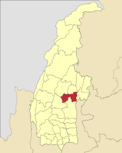
 Location in Kawlin district | |
 Location in Sagaing region | |
| 23°47′N 95°41′E / 23.783°N 95.683°E / 23.783; 95.683 | |
| Country |  Myanmar Myanmar |
| Region | Sagaing Region |
| District | Kawlin District |
| Capital | Kawlin |
| Area | |
| • Township | 1,891.18 km2 (730.19 sq mi) |
| • Urban | 2.75 km2 (1.06 sq mi) |
| • Rural | 1,888.44 km2 (729.13 sq mi) |
| Population (2019)[1] | 151,959 |
| • Urban | 25,254 |
| • Rural | 126,705 |
| Time zone | UTC+6.30 (MST) |
Kawlin Township (Shan: ၸႄႈဝဵင်းၵေႃလၢင်း) is a township in Kawlin District (formerly part of Katha District) in the Sagaing Division of Burma.[2] The principal town is Kawlin.[1]
Administrative divisions
Kawlin Township is divided into eight wards.[1] The rural villages, of which there are 202, are grouped into forty-six "village groups" (ကျေးရွာအုပ်စုအရေအတွက်).[1]
References
- ^ a b c d e စစ်ကိုင်းတိုင်းဒေသကြီး၊ ကောလင်းခရိုင်၊ကောလင်းမြို့နယ်၏ ဒေသဆိုင်ရာအချက်အလက် [Sagaing Region Local information for Kawlin District, Kawlin Township] (in Burmese). Ministry of Union Government Office (MOUGO), Republic of the Union of Myanmar. Archived from the original on 15 August 2022.
- ^ "Myanmar States/Divisions & Townships Overview Map" Archived 3 December 2010 at the Wayback Machine Myanmar Information Management Unit (MIMU)
External links
- Maplandia World Gazetteer - map showing the township boundary
- v
- t
- e
Capital: Monywa


- Kawlin Township (Kawlin)
- Pinlebu Township (Pinlebu)
- Wuntho Township (Wuntho)
  | This Katha District location article is a stub. You can help Wikipedia by expanding it. |
- v
- t
- e


