Ingalls, Oklahoma
Census-designated place in Oklahoma, United States
36°6′6″N 96°52′53″W / 36.10167°N 96.88139°W / 36.10167; -96.88139 (2020)
74074
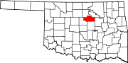
Ingalls is a census-designated place (CDP) in eastern Payne County, Oklahoma, about 9 miles (14 km) east of Stillwater. The town was settled as a result of the "Unassigned Lands" land run in 1889, and had a post office from January 22, 1890, until October 31, 1907.[3] It was named for Senator John J. Ingalls of Kansas.[4] During the 1890s the population peaked at about 150, then began to decline.[5]
History

Ingalls was a peaceful community that rarely ever had any commotion, until it became notable as the site of the Battle of Ingalls on September 1, 1893, which was a shootout between U.S. Marshals and the Doolin-Dalton gang.[6]
A new post office, named Signet, Oklahoma, was established on a site slightly northwest of the old Ingalls townsite on June 21, 1921, and became part of a new community. The residents of the Ingalls part protested and the name was then officially changed back after its closure.[3]
Only a few deserted, old buildings are still present on the Signet site, including replicas of the Ingalls Hotel, its actual name the Pierce O.K. Hotel, a livery stable, saloon, and general store. On the original site, a community building stands that served as the Ingalls School in the mid 20th century, and there are many homes new and old that house families who've had ties to the community for generations. [7]
Demographics
| Census | Pop. | Note | %± |
|---|---|---|---|
| 2020 | 192 | — | |
| U.S. Decennial Census[8] | |||
References
- ^ "ArcGIS REST Services Directory". United States Census Bureau. Retrieved September 20, 2022.
- ^ a b U.S. Geological Survey Geographic Names Information System: Ingalls, Oklahoma
- ^ a b McRill, Leslie. "Old Ingalls: The Story of a Town that Will Not Die." Archived 2006-09-05 at the Wayback Machine, Chronicles of Oklahoma Vol. 36. Retrieved September 16, 2014.
- ^ Gannett, Henry (1905). The Origin of Certain Place Names in the United States. Govt. Print. Off. p. 165.
- ^ ""Oklahoma's Past: Payne County" Oklahoma Archaeological Survey. University of Oklahoma. 23 Oct 2007.
- ^ Samuelson, Nancy B. "Dalton Gang," Encyclopedia of Oklahoma History and Culture, Oklahoma Historical Society. Accessed February 19, 2016
- ^ "The Ingalls Townsite." Oklahoma Archaeology Survey." Retrieved September 12, 2014.
- ^ "Census of Population and Housing". Census.gov. Retrieved June 4, 2016.
Sources
- McRill, Leslie. "Old Ingalls: The Story of a Town That Will Not Die", Chronicles of Oklahoma 36:4 (October 1958) 429-445 (retrieved August 17, 2006)
- "Oklahoma's Past: Payne County" Oklahoma Archaeological Survey. University of Oklahoma. 23 Oct 2007.
- Shirley, Glenn (July 1990). Gunfight at Ingalls: Death of an Outlaw Town. Barbed Wire Pr. p. 180. ISBN 978-0935269062.
External links
- US Marshals Service-Deputies versus the Wild Bunch
- v
- t
- e
Municipalities and communities of Payne County, Oklahoma, United States
County seat: Stillwater
communities
‡This populated place also has portions in an adjacent county or counties
- Oklahoma portal
- United States portal
Authority control databases | |
|---|---|
| International |
|
| National |
|


