Indaial
Place in South, Brazil

Flag

Seal
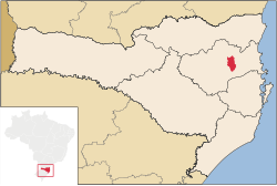
Location of Indaial
 Brazil
 Santa Catarina
 (2020 [1])
Indaial is a city in the state of Santa Catarina, Brazil. It is located on the left bank of Itajaí River, and 160 km from the capital of the state, Florianópolis.
The city is of European origin, with many textiles industries and strong agricultural activity. It was colonized about 1860 by Germans, Italians and Poles. Before the colonization it was populated by Tapajós and Carijós Indians, that are now names of two big neighborhoods in Indaial.
References
- ^ IBGE 2020
- v
- t
- e
Vale do Itajaí mesoregion of Santa Catarina  , Brazil
, Brazil - mesoregions of Santa Catarina
- Grande Florianópolis
- Norte Catarinense
- Oeste Catarinense
- Serrana
- Sul Catarinense
- Vale do Itajaí
Authority control databases | |
|---|---|
| International |
|
| National |
|
 | This Santa Catarina, Brazil location article is a stub. You can help Wikipedia by expanding it. |
- v
- t
- e


