Ibadan North-West
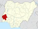
LGA in Oyo State, Nigeria
7°23′34″N 3°52′47″E / 7.3927°N 3.8796°E / 7.3927; 3.8796 Nigeria

Ibadan North-West is a Local Government Area in Oyo State, Nigeria. Its headquarters are at Dugbe/Onireke. The postal code of the area is 200.[1]
History
Ibadan North-west Local Government Area was created in 1991.[2]
Demographics/geography
The average temperature of Ibadan Northwest Local Government Area (LGA) is 28 degrees Celsius, with a total area of 26 square kilometers.[2] The area has an average humidity of 61%, and the LGA receives 2100 mm of precipitation annually.
It has an area of 26 km2 and a population of 152,834 at the 2006 census.
Economy
The Agbeni and Eleyele markets are located in the Ibadan Northwest local government area, which has a thriving trading industry. There are also a number of hotels, banks, and manufacturing facilities in the region.[2]
References
- ^ "Post Offices- with map of LGA". NIPOST. Archived from the original on 2009-10-07. Retrieved 2009-10-20.
- ^ a b c "Ibadan North West Local Government Area". www.manpower.com.ng. Retrieved 2024-02-11.
- v
- t
- e
Oyo StateState capital: Ibadan
- Afijio
- Akinyele
- Atiba
- Atisbo
- Egbeda
- Ibadan North
- Ibadan North-East
- Ibadan North-West
- Ibadan South-East
- Ibadan South-West
- Ibarapa Central
- Ibarapa East
- Ibarapa North
- Ido
- Irepo
- Iseyin
- Itesiwaju
- Iwajowa
- Kajola
- Lagelu
- Ogbomosho North
- Ogbomosho South
- Ogo Oluwa
- Olorunsogo
- Oluyole
- Ona Ara
- Orelope
- Ori Ire
- Oyo East
- Oyo West
- Saki East
- Saki West
- Surulere