High School tram stop
Tram stop on the Nottingham Express Transit tram system in Nottingham, England
| Preceding station | NET | Following station | ||
|---|---|---|---|---|
| The Forest towards Hucknall | Line 1 | Nottingham Trent University towards Toton Lane | ||
| The Forest towards Phoenix Park | Line 2 | Nottingham Trent University towards Clifton South | ||
Location | |
|---|---|
  High School Location in Nottinghamshire, England |
High School is a tram stop on Nottingham Express Transit (NET) in the city of Nottingham suburb of the Arboretum. It takes its name from the nearby Nottingham High School, and is situated in Waverley Street at its intersection with Gedling Grove, an intersection that has been closed to road vehicles by the construction of the stop. The tram tracks here share the road with other traffic, and the stop has two side platforms on either side of the twin tracks, which are themselves separated by a traffic island intended to prevent road vehicles overtaking stationary trams.[1][2]
The tram stop opened on 9 March 2004, along with the rest of NET’s initial system.[1]
With the opening of NET’s phase two, High School is now on the common section of the NET, where line 1, between Hucknall and Chilwell, and line 2, between Phoenix Park and Clifton, operate together. Trams on each line run at frequencies that vary between 4 and 8 trams per hour, depending on the day and time of day, combining to provide up to 16 trams per hour on the common section.[3][4]
High School tram stop is near the top of a steep gradient, which climbs up from Nottingham Trent University tram stop to the south. To the north, the summit of the climb is by the former Vernon Arms, now a branch of Sainsbury's Local, before descending to The Forest tram stop.[1]
Gallery
-
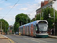 A northbound tram at the High School stop
 -
 Stop sign
 -
 A southbound tram descends the steep gradient


References
- ^ a b c "Nottingham Express Transit : Tram Stops : High School". TheTrams.co.uk. Archived from the original on 26 August 2015. Retrieved 18 August 2015.
- ^ Election Maps (Map). Ordnance Survey. Retrieved 18 August 2015. Viewed for appropriate area with unitary authority ward boundaries and names selected.
- ^ "Extending your Tram Service" (PDF). Nottingham Express Transit. Archived (PDF) from the original on 7 August 2015. Retrieved 18 August 2015.
- ^ "Nottingham Express Transit Phase 2 opens". Railway Gazette. DVV Media UK Ltd. 25 August 2015. Archived from the original on 28 August 2015. Retrieved 25 August 2015.
- v
- t
- e

| Depot(s) | |
|---|---|
| Operator(s) |
|
| Rolling stock |
|
topics
| Development |
|---|
External links
the High School tram stop at Wikipedia's sister projects
 Media from Commons
 Data from Wikidata
 Media related to High School tram stop at Wikimedia Commons


