Guzara
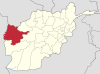
Place in Herat Province, Afghanistan
34°13′0″N 62°13′18″E / 34.21667°N 62.22167°E / 34.21667; 62.22167 Afghanistan
Guzara (Gozareh)[1] is a village and the center of Guzara District in Herat Province, Afghanistan on 34°13′00″N 62°13′00″E / 34.2167°N 62.2167°E / 34.2167; 62.2167 at 992 m altitude. The Herat Airfield is very close to the village to the east.
References
- ^ "Guzara". GEOnet Names Server. Retrieved 12 September 2019.
See also
- Herat Province
- v
- t
- e
Herat Province
Capital: Herat
 | This Herat Province, Afghanistan location article is a stub. You can help Wikipedia by expanding it. |
- v
- t
- e


