Guarizama
Municipality in Olancho, Honduras
14°55′N 86°20′W / 14.917°N 86.333°W / 14.917; -86.333 Honduras
 (2015)
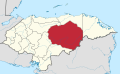
Guarizama is a municipality in the Honduran department of Olancho.
Its name comes from Quanhilzamatil, tight amate tree, probably in the place had that tree.[1]
Historical data
In the population census of 1887 listed as Manto Village in 1901 was given municipality status.
Villages
The municipality has the following five villages: National Institute of Statistics, Honduras. (Census 2001)
- Guarizama
- El Zapotal
- La Carta
- El Rodeo
- Trinidad
Demographics
At the time of the 2013 Honduras census, Guarizama municipality had a population of 7,769. Of these, 98.12% were Mestizo, 1.52% White, 0.19% Black or Afro-Honduran and 0.17% Indigenous.[2]
References
- v
- t
- e
Olancho Department
Capital: Juticalpa
- Campamento
- Catacamas
- Concordia
- Dulce Nombre de Culmí
- El Rosario
- Esquipulas del Norte
- Gualaco
- Guarizama
- Guata
- Guayape
- Jano
- Juticalpa
- La Unión
- Mangulile
- Manto
- Patuca
- Salamá
- San Esteban
- San Francisco de Becerra
- San Francisco de la Paz
- Santa Maria del Real
- Silca
- Yocón
 | This Honduras location article is a stub. You can help Wikipedia by expanding it. |
- v
- t
- e


