Flénu
Sub-municipality of the city of Mons, Belgium
Sub-municipality of Mons in French Community, Belgium
Flénu Flinnu (Walloon) | |
|---|---|
Sub-municipality of Mons | |
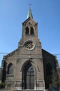 Sainte-Barbe Church | |
Location of Flénu  | |
 Location of Flénu in Mons | |
50°26′12″N 3°53′15″E / 50.43667°N 3.88750°E / 50.43667; 3.88750 | |
| Country |  Belgium Belgium |
| Community |  French Community French Community |
| Region | Wallonia |
| Province |  Hainaut Hainaut |
| Arrondissement | Mons |
| Municipality | Mons |
| Area | |
| • Total | 3.86 km2 (1.49 sq mi) |
| Population (2020-01-01) | |
| • Total | 5,669 |
| • Density | 1,500/km2 (3,800/sq mi) |
| Postal codes | 7012 |
| Area codes | 065 |
Flénu (French pronunciation: [fleny]; Walloon: Flinnu) is a sub-municipality of the city of Mons located in the province of Hainaut, Wallonia, Belgium. The municipality of Flénu was formed on 8 June 1870, when it was detached from the municipality of Jemappes.[1][2] In 1971, Flénu was merged into Jemappes. On 1 January 1977, Jemappes was merged into Mons.[3]
References
Wikimedia Commons has media related to Flénu.
 | This Hainaut Province location article is a stub. You can help Wikipedia by expanding it. |
- v
- t
- e


