Elliott, Maryland
Census-designated place in Maryland, United States
38°18′36″N 75°59′47″W / 38.31000°N 75.99639°W / 38.31000; -75.99639 United States
 Maryland
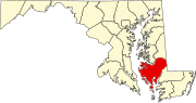
 Dorchester
 (2020)
21869
Elliott is an unincorporated community and census-designated place (CDP) in Dorchester County, Maryland, United States.[2] The population was 52 at the 2010 census.[3]
Geography
Elliott is located in southern Dorchester County on Elliott Island, on the east side of Fishing Bay. Elliott Island Road is the only road access to the town, leading 19 miles (31 km) northeast to U.S. Route 50 at Vienna.
According to the United States Census Bureau, the Elliott CDP has a total area of 0.36 square miles (0.92 km2), of which 73,250 square feet (6,805 m2), or 0.74%, is water.[3]
Demographics
| Census | Pop. | Note | %± |
|---|---|---|---|
| 2020 | 43 | — | |
| U.S. Decennial Census[4] | |||
References
- ^ "2020 U.S. Gazetteer Files". United States Census Bureau. Retrieved April 26, 2022.
- ^ U.S. Geological Survey Geographic Names Information System: Elliott, Maryland
- ^ a b "Geographic Identifiers: 2010 Demographic Profile Data (G001): Elliott CDP, Maryland". U.S. Census Bureau, American Factfinder. Retrieved October 29, 2015.[dead link]
- ^ "Census of Population and Housing". Census.gov. Retrieved June 4, 2016.
- v
- t
- e
Municipalities and communities of Dorchester County, Maryland, United States
County seat: Cambridge
- Algonquin
- Elliott
- Fishing Creek
- Madison
- Taylors Island
communities
‡This populated place also has portions in an adjacent county or counties
- Maryland portal
- United States portal
This article about a location in Dorchester County, Maryland is a stub. You can help Wikipedia by expanding it. |
- v
- t
- e


