Burbank, South Dakota
Unincorporated community in South Dakota, United States
42°44′46″N 96°49′58″W / 42.74611°N 96.83278°W / 42.74611; -96.83278 (2020)[3]
57010
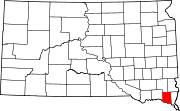
Burbank is an unincorporated community and a census-designated place (CDP) in Clay County, South Dakota, United States.[2] The population was 93 at the 2020 census.[4]
Burbank was laid out in 1873, and it is named in honor of John A. Burbank, the fourth Governor of Dakota Territory.[5]
Demographics
| Census | Pop. | Note | %± |
|---|---|---|---|
| 2020 | 93 | — | |
| U.S. Decennial Census[6] | |||
References
- ^ "ArcGIS REST Services Directory". United States Census Bureau. Retrieved October 15, 2022.
- ^ a b c U.S. Geological Survey Geographic Names Information System: Burbank, South Dakota
- ^ "Census Population API". United States Census Bureau. Retrieved October 15, 2022.
- ^ "U.S. Census Bureau: Burbank CDP, South Dakota". www.census.gov. United States Census Bureau. Retrieved July 21, 2022.
- ^ Federal Writers' Project (1940). South Dakota place-names, v.1-3. University of South Dakota. p. 29.
- ^ "Census of Population and Housing". Census.gov. Retrieved June 4, 2016.
- v
- t
- e
Municipalities and communities of Clay County, South Dakota, United States
County seat: Vermillion
- Burbank
- Meckling
communities
‡This populated place also has portions in an adjacent county or counties
- South Dakota portal
- United States portal
Authority control databases | |
|---|---|
| International |
|
| National |
|
 | This South Dakota state location article is a stub. You can help Wikipedia by expanding it. |
- v
- t
- e


