Box Elder, South Dakota
City in South Dakota, United States
Box Elder, South Dakota čhaŋšúška | |
|---|---|
City | |
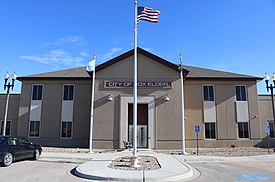 Box Elder City Hall | |
| Nickname: Gateway to the Black Hills | |
 Location in Pennington County and the state of South Dakota | |
| Coordinates: 44°06′43″N 103°04′54″W / 44.11194°N 103.08167°W / 44.11194; -103.08167 | |
| Country | United States |
| State | South Dakota |
| Counties | Pennington, Meade |
| Founded | 1907[1] |
| Incorporated | May 12, 1965[2] |
| Government | |
| • Mayor | Larry Larson |
| Area | |
| • Total | 14.777 sq mi (38.272 km2) |
| • Land | 14.753 sq mi (38.209 km2) |
| • Water | 0.024 sq mi (0.061 km2) |
| Elevation | 3,045 ft (928 m) |
| Population (2020)[5] | |
| • Total | 11,746 |
| • Estimate (2023)[6] | 13,868 |
| • Density | 796.18/sq mi (307.41/km2) |
| Time zone | UTC–7 (Mountain (MST)) |
| • Summer (DST) | UTC–6 (CDT) |
| ZIP Code | 57719 |
| Area code | 605 |
| FIPS code | 46-06620 |
| GNIS feature ID | 1267290[4] |
| Sales tax | 6.2%[7] |
| Website | boxelder.us |
Box Elder (Lakota: čhaŋšúška;[8] "box elder maple") is a city in Pennington and Meade counties in the State of South Dakota. The population was 11,746 at the 2020 census, making it the 10th most populous city in South Dakota.[5] Ellsworth Air Force Base lies on the northeast side of the city.
Box Elder was named from nearby Boxelder Creek.[9]
Indie Rock band Pavement has a song on their second album named after the city.
Geography
According to the United States Census Bureau, the city has a total area of 14.777 square miles (38.27 km2), of which 14.753 square miles (38.21 km2) is land and 0.024 square miles (0.06 km2) is water.[3]
Box Elder is located within minutes of Ellsworth AFB, and surrounds it on three sides.
Climate
| Climate data for Rapid City, South Dakota (Rapid City Regional Airport), 1981−2010 normals | |||||||||||||
|---|---|---|---|---|---|---|---|---|---|---|---|---|---|
| Month | Jan | Feb | Mar | Apr | May | Jun | Jul | Aug | Sep | Oct | Nov | Dec | Year |
| Record high °F (°C) | 76 (24) | 75 (24) | 83 (28) | 93 (34) | 98 (37) | 109 (43) | 111 (44) | 107 (42) | 104 (40) | 94 (34) | 83 (28) | 75 (24) | 111 (44) |
| Mean daily maximum °F (°C) | 37 (3) | 40 (4) | 48 (9) | 58 (14) | 68 (20) | 78 (26) | 87 (31) | 86 (30) | 76 (24) | 61 (16) | 47 (8) | 37 (3) | 60 (16) |
| Mean daily minimum °F (°C) | 13 (−11) | 15 (−9) | 23 (−5) | 32 (0) | 42 (6) | 51 (11) | 58 (14) | 57 (14) | 46 (8) | 34 (1) | 22 (−6) | 13 (−11) | 34 (1) |
| Record low °F (°C) | −27 (−33) | −31 (−35) | −21 (−29) | 1 (−17) | 18 (−8) | 31 (−1) | 39 (4) | 38 (3) | 18 (−8) | −2 (−19) | −19 (−28) | −30 (−34) | −31 (−35) |
| Average precipitation inches (mm) | 0.30 (7.6) | 0.46 (12) | 0.93 (24) | 1.80 (46) | 3.22 (82) | 2.53 (64) | 1.85 (47) | 1.56 (40) | 1.29 (33) | 1.42 (36) | 0.53 (13) | 0.42 (11) | 16.31 (415.6) |
| Source: The Weather Channel (Historical Monthly Averages) [10] | |||||||||||||
Demographics
| Census | Pop. | Note | %± |
|---|---|---|---|
| 1970 | 607 | — | |
| 1980 | 3,186 | 424.9% | |
| 1990 | 2,680 | −15.9% | |
| 2000 | 2,841 | 6.0% | |
| 2010 | 7,800 | 174.6% | |
| 2020 | 11,746 | 50.6% | |
| 2023 (est.) | 13,868 | [6] | 18.1% |
| U.S. Decennial Census[11] 2020 Census[5] | |||
2020 census
| Race | Number | Percent |
|---|---|---|
| White (NH) | 8,340 | 71.0% |
| Black or African American (NH) | 402 | 3.4% |
| Native American (NH) | 787 | 6.7% |
| Asian (NH) | 216 | 1.8% |
| Pacific Islander (NH) | 41 | 0.3% |
| Some Other Race (NH) | 68 | 0.6% |
| Mixed/Multi-Racial (NH) | 984 | 8.4% |
| Hispanic or Latino | 908 | 7.7% |
| Total | 11,746 | 100.0% |
As of the 2020 census, there were 11,746 people, 4,123 households, and 2,992 families residing in the city.[13] The population density was 809.7 inhabitants per square mile (312.6/km2). There were 4,373 housing units. The racial makeup of the city was 73.6% White, 3.6% African American, 7.4% Native American, 1.9% Asian, 0.3% Pacific Islander, 2.1% from some other races and 11.0% from two or more races. Hispanic or Latino of any race were 7.7% of the population.[14] 24.9% of residents were under the age of 18, 8.1% were under 5 years of age, and 6.7% were 65 and older.
2010 census
As of the 2010 census, there were 7,800 people, 2,443 households, and 1,968 families residing in the city. The population density was 561.1 inhabitants per square mile (216.6/km2). There were 2,828 housing units at an average density of 203.5 per square mile (78.6/km2). The racial makeup of the city was 79.5% White, 5.1% African American, 4.4% Native American, 2.2% Asian, 0.4% Pacific Islander, 2.4% from other races, and 6.0% from two or more races. Hispanic or Latino of any race were 7.9%.
Of the 2,443 households, 55.2% had children under the age of 18 living with them, 60.6% were married couples living together, 14.1% had a female householder with no husband present, 5.8% had a male householder with no wife present, and 19.4% were non-families. 15.1% of households were one person, and 2% were one person aged 65 or older. The average household size was 2.95 and the average family size was 3.26.
The median age was 23.5 years. 33.6% of residents were under the age of 18; 20.4% were between the ages of 18 and 24; 30.3% were from 25 to 44; 13% were from 45 to 64, and 2.9% were 65 or older. The gender makeup of the city was 51.9% male and 48.1% female.
2000 census
As of the 2000 census, there were 2,841 people, 993 households, and 750 families residing in the city. The population density was 489.6 inhabitants per square mile (189.0/km2). There were 1,072 housing units at an average density of 184.8 per square mile (71.4/km2). The racial makeup of the city was 83.42% White, 2.29% African American, 5.60% Native American, 2.08% Asian, 0.11% Pacific Islander, 0.70% from other races, and 5.81% from two or more races. Hispanic or Latino of any race were 3.56% of the population.
Of the 993 households, 48.0% had children under the age of 18 living with them, 50.4% were married couples living together, 19.6% had a female householder with no husband present, and 24.4% were non-families. 17.3% of households were one person, and 1.8% were one person aged 65 or older. The average household size was 2.86 and the average family size was 3.20.
The age distribution was 34.6% under the age of 18, 13.1% from 18 to 24, 30.9% from 25 to 44, 18.2% from 45 to 64, and 3.3% 65 or older. The median age was 26 years. For every 100 females, there were 98.9 males. For every 100 females age 18 and over, there were 95.7 males.
The median household income was $32,344 and the median family income was $35,020. Males had a median income of $24,596 versus $17,313 for females. The per capita income for the city was $12,692. About 13.0% of families and 15.9% of the population were below the poverty line, including 21.3% of those under age 18 and 6.9% of those aged 65 or over.
Schools
Douglas School District serves families in Box Elder and those living on Ellsworth AFB.[15] The school district operates six schools in Box Elder:
- Carrousel (Pre-Kindergarten)
- Badger Clark Elementary (Kindergarten - 3rd grade)
- Francis Case Elementary (Kindergarten - 3rd grade)
- Vandenberg Elementary (4th - 5th grade)
- Douglas Middle School (6th - 8th grade)
- Douglas High School (9th - 12th grade)[16]
The school's athletics teams are the Douglas Patriots.[15]
Points of interest
Notable people
- Jeffrey W. Hayzlett, author, speaker, businessman
- Nellie Zabel Willhite, first deaf woman to earn a pilot's license
References
- ^ "History of Box Elder, SD". City of Box Elder. Archived from the original on February 11, 2010. Retrieved February 11, 2010.
- ^ "SD Towns" (PDF). South Dakota State Historical Society. Archived from the original (PDF) on February 10, 2010. Retrieved February 11, 2010.
- ^ a b "2023 U.S. Gazetteer Files". United States Census Bureau. Retrieved May 22, 2024.
- ^ a b U.S. Geological Survey Geographic Names Information System: Box Elder, South Dakota
- ^ a b c "Explore Census Data". United States Census Bureau. Retrieved December 14, 2023.
- ^ a b "City and Town Population Totals: 2020-2023". United States Census Bureau. May 22, 2024. Retrieved May 22, 2024.
- ^ "Box Elder (SD) sales tax rate". Retrieved May 22, 2024.
- ^ Ullrich, Jan F. (2014). New Lakota Dictionary (2nd ed.). Bloomington, IN: Lakota Language Consortium. ISBN 978-0-9761082-9-0. Archived from the original on October 18, 2016. Retrieved February 12, 2014.
- ^ Chicago and North Western Railway Company (1908). A History of the Origin of the Place Names Connected with the Chicago & North Western and Chicago, St. Paul, Minneapolis & Omaha Railways. p. 46.
- ^ "Climate Statistics for Box Elder, SD". Retrieved September 30, 2013.
- ^ "Census of Population and Housing". census.gov. Retrieved June 4, 2015.
- ^ "P2 HISPANIC OR LATINO, AND NOT HISPANIC OR LATINO BY RACE – 2020: DEC Redistricting Data (PL 94-171) – Box Elder city, South Dakota".
- ^ "US Census Bureau, Table P16: Household Type". United States Census Bureau. Retrieved May 22, 2024.
- ^ "How many people live in Box Elder city, South Dakota". USA Today. Retrieved May 22, 2024.
- ^ a b "Douglas School District". www.dsdk12.net.
- ^ "Douglas School District 51-1 | Ellsworth AFB School Liaison Officer". Archived from the original on September 24, 2020. Retrieved September 8, 2020.
- v
- t
- e
Municipalities and communities of Meade County, South Dakota, United States
County seat: Sturgis

communities
‡This populated place also has portions in an adjacent county or counties
- South Dakota portal
- United States portal
Municipalities and communities of Pennington County, South Dakota, United States | ||
|---|---|---|
County seat: Rapid City | ||
| Cities |
|  |
| Towns | ||
| CDPs | ||
| Former CDP | ||
| Other communities | ||
| Ghost towns | ||
| Footnotes | ‡This populated place also has portions in an adjacent county or counties | |
| ||


