Bismarck, Arkansas
Township in Arkansas, United States
34°19′04″N 93°10′41″W / 34.31778°N 93.17806°W / 34.31778; -93.17806 (2020)
71929
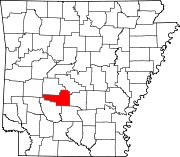
Bismarck is a rural unincorporated community and census-designated place (CDP) in Hot Spring County, Arkansas. It was first listed as a CDP in the 2020 census with a population of 2,332. It is located between Hot Springs and Caddo Valley, centered around the intersection of State Hwy 7 and State Hwy 84 in Hot Spring County, Arkansas, United States.[2]
Demographics
| Census | Pop. | Note | %± |
|---|---|---|---|
| 2020 | 229 | — | |
| U.S. Decennial Census[3] 2020[4] | |||
2020 census
| Race / Ethnicity (NH = Non-Hispanic) | Pop 2020[4] | % 2020 |
|---|---|---|
| White alone (NH) | 184 | 80.35% |
| Black or African American alone (NH) | 1 | 0.44% |
| Native American or Alaska Native alone (NH) | 4 | 1.75% |
| Asian alone (NH) | 0 | 0.00% |
| Pacific Islander alone (NH) | 0 | 0.00% |
| Some Other Race alone (NH) | 0 | 0.00% |
| Mixed Race or Multi-Racial (NH) | 16 | 6.99% |
| Hispanic or Latino (any race) | 24 | 10.48% |
| Total | 229 | 100.00% |
Education
Public education is provided by the Bismarck School District,[5][6] which provides elementary and secondary education.
References
- ^ a b U.S. Geological Survey Geographic Names Information System: Bismarck, Arkansas
- ^ "Bismarck". www.arkansas.com. Archived from the original on January 31, 2013. Retrieved April 1, 2013.
- ^ "Decennial Census of Population and Housing by Decades". US Census Bureau.
- ^ a b "P2 Hispanic or Latino, and Not Hispanic or Latino by Race – 2020: DEC Redistricting Data (PL 94-171) – Bismarck CDP, Arkansas". United States Census Bureau.
- ^ "SCHOOL DISTRICT REFERENCE MAP (2010 CENSUS): Hot Spring County, AR", U.S. Census Bureau. Retrieved March 6, 2021.
- ^ "General Highway Map Hot Spring County, Arkansas" (PDF). Arkansas Department of Transportation. Retrieved March 6, 2021. - See Bismarck on the map.
- v
- t
- e
Municipalities and communities of Hot Spring County, Arkansas, United States
County seat: Malvern
- Antioch
- Big Creek
- Bismarck
- Brown Springs
- Butterfield
- Clear Creek
- De Roche
- Dover
- Fenter
- Gifford
- Harrison
- Henderson
- Lone Hill
- Magnet
- Midway
- Montgomery
- Ouachita
- Prairie
- Saline
- Valley
- Bismarck
- Jones Mills
- Magnet Cove
communities
- Arkansas portal
- United States portal
Authority control databases | |
|---|---|
| International |
|
| National |
|
| Geographic |
|
 | This article about a location in Hot Spring County, Arkansas is a stub. You can help Wikipedia by expanding it. |
- v
- t
- e


