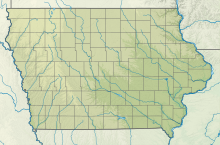
Arthur N. Neu Airport


| Direction | Length | Surface | |
|---|---|---|---|
| ft | m | ||
| 13/31 | 5,506 | 1,678 | Concrete |
| 3/21 | 3,301 | 1,006 | Concrete |
| Aircraft operations (2015) | 7,700 |
|---|---|
| Based aircraft (2017) | 16 |
Arthur N. Neu Airport (IATA: CIN, ICAO: KCIN, FAA LID: CIN) is a public airport five miles southeast of Carroll, in Carroll County, Iowa.[1] Also known as Arthur N. Neu Municipal Airport, it was established at its current location in the 1940s.[2]
Facilities
Arthur N. Neu Airport covers 300 acres (120 ha) at an elevation of 1,204 feet (367 m). It has two lighted runways: Runway 13/31 is 5,506 by 100 feet (1,676 x 30 m) with an instrument approach and non-directional beacon. Runway 3/21 is 3,301 by 60 feet (1,006 x 18 m).[1][2]
In the year ending August 20, 2017, the airport had 7,700 aircraft operations, average 21 per day: 91% general aviation, 8% air taxi and <1% military. In January 2017, 16 aircraft were based at the airport: 11 single-engine, 4 multi-engine and 1 ultralight.[1] The airport has hangar space for 24 aircraft.[2]
See also
References
- ^ a b c d FAA Airport Form 5010 for CIN PDF, effective Jan 5, 2017.
- ^ a b c Arthur N. Neu Municipal Airport Archived May 24, 2009, at the Wayback Machine page at City of Carroll website
External links
- Carroll Municipal - Arthur N. Neu (CIN) at Iowa DOT Airport Directory
- FAA Terminal Procedures for CIN, effective June 13, 2024
- Resources for this airport:
- FAA airport information for CIN
- AirNav airport information for KCIN
- ASN accident history for CIN
- FlightAware airport information and live flight tracker
- NOAA/NWS weather observations: current, past three days
- SkyVector aeronautical chart, Terminal Procedures
- v
- t
- e
- Albia
- Algona
- Ames
- Atlantic
- Audubon
- Belle Plaine
- Bloomfield
- Boone
- Carroll
- Centerville
- Chariton
- Charles City
- Cherokee
- Clarinda
- Clarion
- Clinton
- Council Bluffs
- Creston
- Davenport
- Decorah
- Denison
- Emmetsburg
- Estherville
- Fairfield
- Forest City
- Fort Madison
- Greenfield
- Grinnell
- Guthrie Center
- Hampton
- Harlan
- Humboldt
- Independence
- Iowa City
- Iowa Falls
- Jefferson
- Keokuk
- Knoxville
- Lamoni
- Le Mars
- Mapleton
- Maquoketa
- Marshalltown
- Monticello
- Mt. Pleasant
- Muscatine
- Newton
- Oelwein
- Orange City
- Osceola
- Oskaloosa
- Ottumwa
- Pella
- Perry
- Pocahontas
- Red Oak
- Rockwell City
- Sac City
- Sheldon
- Shenandoah
- Spencer
- Storm Lake
- Tipton
- Vinton
- Washington
- Waverly
- Webster City
- West Union
- Winterset


