Alapars
Village in Kotayk, Armenia
Alapars Ալափարս | |
|---|---|
Village | |
 A view of Alapars | |
| 40°25′17″N 44°38′05″E / 40.42139°N 44.63472°E / 40.42139; 44.63472 | |
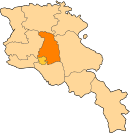
| Country |  Armenia Armenia |
| Province | Kotayk |
| Founded | 470, resettled in 1828-30 |
| Area | |
| • Total | 32.94 km2 (12.72 sq mi) |
| Elevation | 1,500−1,601 m (−3,753 ft) |
| Population (2011)[1] | |
| • Total | 2,076 |
| • Density | 63/km2 (160/sq mi) |
| Time zone | UTC+4 (AMT) |
| Area code | +374 (226) |
| Alapars at GEOnet Names Server | |
Alapars (Armenian: Ալափարս) is a village in the Kotayk Province of Armenia. The village has 860 dwellings, a school, house of culture, and library. The population is entirely Armenian.
Toponymy
The village was previously known as Aylaberk and Aylaber.
History
Alapars was founded in 470, but was resettled in 1828-30 by immigrants from Khoy and Maku. Its center is dominated by the churches of Saint Vartan (Vartanavank) built in 901 (rebuilt 19th century) by a Prince Grigor, and the Holy Mother of God (Surb Astvatsatsin) of 1897. Also in the vicinity is the monastery of S. Tsiranavor. According to local folklore, Vartanavank contains a drop of blood from the Armenian national hero Vartan Mamikonian.[2][3]
Gallery
-
 The church of Vardanavank built in 901, reconstructed in the 19th century
 -
 St. Astvatsatsin Church (Holy Mother of God Church), 1897
 -
 Large khachkar adjacent to Vartanavank
 -
 Sculpture in Tukh Manuk, Alapars by Avetik Avetyan, words by Avetik Isahakyan


Notable people
- Avetik Avetyan, USSR multiple medalist and director of the pump station of Alapars
- Mushegh Aliabertsi, Patriarch (490-561)
- Tatik Saryan, artist
- Melik Kocharyan, dramatist
- Shavigh Grigoryan, folk collector
- Kavalenko Shahgaldyan, Governor of the Kotayk Province
References
- ^ Statistical Committee of Armenia. "The results of the 2011 Population Census of Armenia" (PDF).
- ^ "Alapars (Kotayk)". CAA: Union of Communities of Armenia. Archived from the original on June 22, 2015. Retrieved May 30, 2015.
- ^ Kiesling, Brady; Kojian, Raffi (2005). Rediscovering Armenia: Guide (2nd ed.). Yerevan: Matit Graphic Design Studio. p. 95. ISBN 99941-0-121-8.
External links
Wikimedia Commons has media related to Alapars.
- Report of the results of the 2001 Armenian Census, Statistical Committee of Armenia
- Kiesling, Brady (2005), Rediscovering Armenia: Guide, Yerevan, Armenia: Matit Graphic Design Studio
- Kiesling, Brady (June 2000). Rediscovering Armenia: An Archaeological/Touristic Gazetteer and Map Set for the Historical Monuments of Armenia (PDF). Archived (PDF) from the original on 6 November 2021.
- v
- t
- e
Capital: Hrazdan
Portal:
 Geography


