Água Branca, Alagoas
You can help expand this article with text translated from the corresponding article in Portuguese. Click [show] for important translation instructions.
- Machine translation, like DeepL or Google Translate, is a useful starting point for translations, but translators must revise errors as necessary and confirm that the translation is accurate, rather than simply copy-pasting machine-translated text into the English Wikipedia.
- Consider adding a topic to this template: there are already 1,531 articles in the main category, and specifying
|topic=will aid in categorization. - Do not translate text that appears unreliable or low-quality. If possible, verify the text with references provided in the foreign-language article.
- You must provide copyright attribution in the edit summary accompanying your translation by providing an interlanguage link to the source of your translation. A model attribution edit summary is
Content in this edit is translated from the existing Portuguese Wikipedia article at [[:pt:Água Branca (Alagoas)]]; see its history for attribution. - You may also add the template
{{Translated|pt|Água Branca (Alagoas)}}to the talk page. - For more guidance, see Wikipedia:Translation.
09°15′39″S 37°56′10″W / 9.26083°S 37.93611°W / -9.26083; -37.93611
Place in Alagoas, Brazil

Flag

Seal


Água Branca
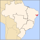
Location in Brazil
 Brazil
 (2020 est [1])
Água Branca is a municipality located in the western of the state of Alagoas. Its population 20,230 (2020) and its area is 455 km².[2]
Geography
Climate
| Climate data for Água Branca, Alagoas (1981–2010, extremes 1912–present) | |||||||||||||
|---|---|---|---|---|---|---|---|---|---|---|---|---|---|
| Month | Jan | Feb | Mar | Apr | May | Jun | Jul | Aug | Sep | Oct | Nov | Dec | Year |
| Record high °C (°F) | 37.3 (99.1) | 35.6 (96.1) | 39.1 (102.4) | 39.1 (102.4) | 38.6 (101.5) | 34.6 (94.3) | 29.6 (85.3) | 30.6 (87.1) | 34.0 (93.2) | 39.6 (103.3) | 36.4 (97.5) | 38.1 (100.6) | 39.6 (103.3) |
| Mean daily maximum °C (°F) | 30.9 (87.6) | 31.1 (88.0) | 30.5 (86.9) | 29.0 (84.2) | 26.9 (80.4) | 24.7 (76.5) | 24.1 (75.4) | 24.9 (76.8) | 27.6 (81.7) | 30.0 (86.0) | 31.2 (88.2) | 31.3 (88.3) | 28.5 (83.3) |
| Daily mean °C (°F) | 24.8 (76.6) | 24.9 (76.8) | 24.7 (76.5) | 23.9 (75.0) | 22.5 (72.5) | 20.9 (69.6) | 20.2 (68.4) | 20.3 (68.5) | 21.8 (71.2) | 23.5 (74.3) | 24.6 (76.3) | 24.9 (76.8) | 23.1 (73.6) |
| Mean daily minimum °C (°F) | 20.0 (68.0) | 20.3 (68.5) | 20.5 (68.9) | 20.3 (68.5) | 19.5 (67.1) | 18.4 (65.1) | 17.7 (63.9) | 17.3 (63.1) | 17.8 (64.0) | 18.7 (65.7) | 19.5 (67.1) | 20.1 (68.2) | 19.2 (66.6) |
| Record low °C (°F) | 16.0 (60.8) | 16.4 (61.5) | 11.2 (52.2) | 16.5 (61.7) | 12.9 (55.2) | 14.3 (57.7) | 13.0 (55.4) | 11.7 (53.1) | 13.6 (56.5) | 12.0 (53.6) | 10.7 (51.3) | 16.6 (61.9) | 10.7 (51.3) |
| Average precipitation mm (inches) | 39.7 (1.56) | 57.0 (2.24) | 108.5 (4.27) | 85.0 (3.35) | 147.9 (5.82) | 178.4 (7.02) | 164.9 (6.49) | 99.8 (3.93) | 41.5 (1.63) | 29.5 (1.16) | 28.4 (1.12) | 42.0 (1.65) | 1,022.6 (40.26) |
| Average precipitation days (≥ 1.0 mm) | 3 | 4 | 7 | 8 | 13 | 17 | 16 | 13 | 6 | 3 | 2 | 3 | 95 |
| Average relative humidity (%) | 72.0 | 70.6 | 77.5 | 83.3 | 86.8 | 91.6 | 91.4 | 88.0 | 79.8 | 74.4 | 72.8 | 72.9 | 80.1 |
| Mean monthly sunshine hours | 239.8 | 221.8 | 226.7 | 212.4 | 181.4 | 142.1 | 156.9 | 187.6 | 229.0 | 268.6 | 263.1 | 264.9 | 2,594.3 |
| Source 1: Instituto Nacional de Meteorologia[3] | |||||||||||||
| Source 2: Meteo Climat (record highs and lows)[4] | |||||||||||||
References
- v
- t
- e

Capital: Maceió
- Arapiraca
- Campo Grande
- Coité do Nóia
- Craíbas
- Feira Grande
- Girau do Ponciano
- Lagoa da Canoa
- Limoeiro de Anadia
- São Sebastião
- Taquarana
- Água Branca
- Canapi
- Inhapi
- Mata Grande
- Pariconha
 | This Alagoas, Brazil location article is a stub. You can help Wikipedia by expanding it. |
- v
- t
- e


