Badia d'Arguin
| ||||
| Tipus | Badia i banc de sorra  | |||
|---|---|---|---|---|
| Localització | ||||
| Entitat territorial administrativa | Dakhlet Nouadhibou (Mauritània) | |||
| ||||
| Banyat per | oceà Atlàntic | |||

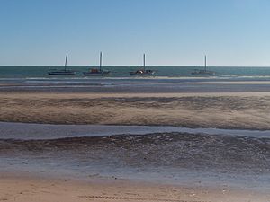

La badia (o golf) d'Arguin, també banc d'Arguin és una àmplia badia africana de l'oceà Atlàntic que es troba a la costa septentrional de Mauritània. Està limitada al nord pel cap Blanc i al sud pel cap Timiris. Al seu interior es troba l'arxipèlag del golf d'Arguin, un conjunt d'illes costaneres que comprèn les illes majors d'Arguin i Tidra i moltes illes menors i illots. La major part de les seves aigües, uns 12.000 km², formen part del Parc Nacional del Banc d'Arguin.
Història
La badia va ser donada a conèixer el 1035, quan Abd-Al·lah ibn Yassín hi fundà un ribat, que fou l'origen de la dinastia almoràvit.[1]
El primer europeu en visitar la badia fou Nuno Tristão el 1443.[2]
La zona també és coneguda per ser el lloc on va naufragar la fragata francesa La Medusa el 1816.[3]
Referències
- ↑ [enllaç sense format] http://www.terremauritanie.com/noticias-todas-las-informaciones-historia-historia-de-la-mauritania-news-_23.html Arxivat 2016-10-24 a Wayback Machine.
- ↑ Diffie, Bailey. Foundations of the Portuguese Empire, 1415–1580. University of Minnesota Press, 1977, p. 465–474. ISBN 0-8166-0782-6.
- ↑ Corréard, Alexandre; Savigny, Jean Baptiste Henri. Narrative of a Voyage to Senegal in 1816 Undertaken by Order of the French Government, Comprising an Account of the Shipwreck of the Medusa, the Sufferings of the Crew, and the Various Occurrences on Board the Raft, in the Desert of Zaara, at St. Louis, and at the Camp of Daccard. to Which Are Subjoined Observations Respecting the Agriculture of the Western Coast of Africa, from Cape Blanco to the Mouth of the Gambia. (en anglès), 2004-04-01.
